1. China Aero Geophysical Survey and Remote Sensing Center for Land and Resources,Beijing 100083,China 2. Qinghai Bureau of Environmental Geology and Exploration, Xining 810007,China 3. School of the Earth and Resources, China University of Geosciences(Beijing),Beijing 100083,China
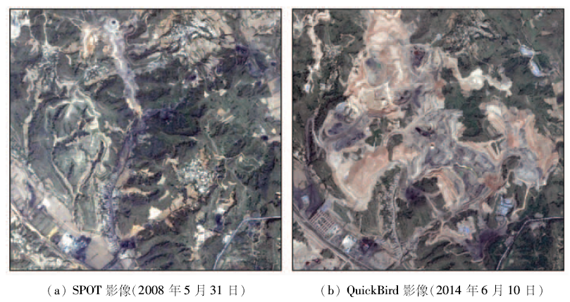
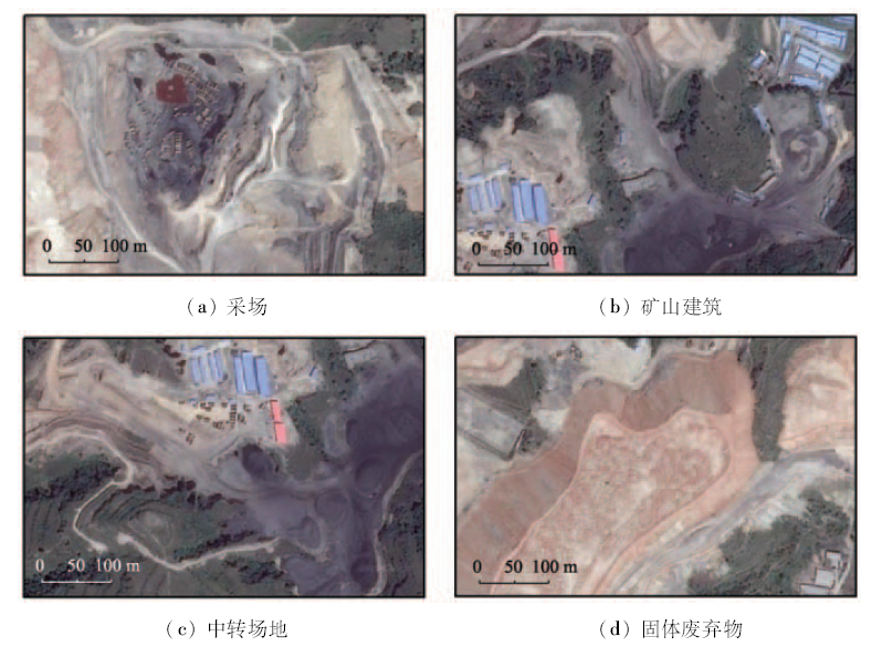
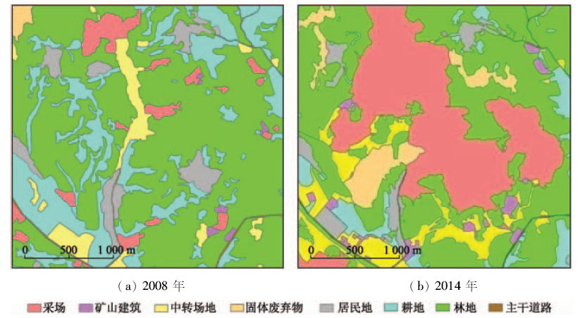
The remote sensing images which were obtained respectively in 2008 and 2014 were used in a certain area of Shanxi Province. By using ArcGIS softwere, human and computer interaction interpretation method was used to delineate the mining land and non-mining land respectively. The monitoring results show that, from 2008 to 2014, the proportion of mining land in the study area increased by about 35%, and the mining lands grew rapidly. The change of mining manner was the main reason for the increase of mining land. The increase of mining land was mainly attributed to the occupation of the forest land and cultivated land.
王海庆, 武明德, 刘琼, 李光昭, 王昊, 李丽. 山西某地矿业开发占用土地状况遥感监测[J]. 国土资源遥感, 2018, 30(1): 116-120.
Haiqing WANG, Mingde WU, Qiong LIU, Guangzhao LI, Hao WANG, Li LI. Remote sensing monitoring of mining land in a certain area of Shanxi Province. Remote Sensing for Land & Resources, 2018, 30(1): 116-120.
Liu H F,Liu Y Z,Bi R T,et al.Reuse type judgment of mining wasteland based on land use competitiveness[J].Transactions of the Chinese Society of Agricultural Engineering,2016,32(10):258-266.
Yang X H,Huang J,Tian L,et al.The application of remote sensing technique to the study of present situation and changes of land occupied by main mines in Sichuan[J].Acta Geologica Sichuan,2012,32(4):482-486.
He L Z,Hong J Y,Zhang J G,et al.Research on extraction of land information used by mining development based on IKONOS remote sensing data[J].Remote Sensing for Land and Resources,2013,25(1):150-154.doi:10.6046/gtzyyg.2013.01.26.
Wang G M,Zhu J F,Wu G Z,et al.The remote sensing surveillance and compositive research of mine exploitation impropriate soil in Guangdong Province[J].Geology and Mineral Resources of South China,2015,31(4):406-413.
Zhang Y J,Han F,Yang Y,et al.QuickBird image based investigation on land occupation of exploitation mining in Shitanjing mine area[J].Ningxia Engineering Technology,2015,14(4):331-333.
 2018, Vol. 30
  ), 武明德2, 刘琼1, 李光昭3, 王昊1, 李丽1