Please wait a minute...
 
国土资源遥感  2019, Vol. 31 Issue (4): 79-87    DOI: 10.6046/gtzyyg.2019.04.11
  技术方法 本期目录 | 过刊浏览 | 高级检索 |
基于多源数据的郯庐断裂带安徽段遥感解译及其空间分布特征
赵卫东1,2,3, 郑勇1, 章浩南1,2, 姜琼3, 卫佳佳1,2
1. 合肥工业大学资源与环境工程学院,合肥 230009
2. 合肥工业大学智能制造技术研究院,合肥 230088
3. 合肥工业大学土木与水利工程学院,合肥 230009
Remote sensing interpretation and spatial distribution characteristics of the Anhui segment of Tanlu fault zone based on multi-source data
Weidong ZHAO1,2,3, Yong ZHENG1, Haonan ZHANG1,2, Qiong JIANG3, Jiajia WEI1,2
1. School of Resource and Environmental Engineering, Hefei University of Technology, Hefei 230009, China
2. Intelligent Manufacturing Technology Institute, Hefei University of Technology, Hefei 230088, China
3. School of Civil and Hydraulic Engineering, Hefei University of Technology, Hefei 230009, China
全文: PDF(6914 KB)   HTML  
输出: BibTeX | EndNote (RIS)      
摘要 

在以往的郯庐断裂带安徽段研究过程中,普遍认为郯庐断裂带安徽段由五河—合肥断裂、石门山断裂、池河—太湖断裂以及嘉山—庐江断裂4条主干断裂共同构成,但对于该断裂带的准确边界位置缺乏全面和系统的研究,尤其是郯庐断裂带安徽段南部大别山区域的边界问题。为此,基于Landsat8、资源3号影像与数字高程模型(digital elevation model,DEM)等多源数据,综合利用GIS空间分析和空间统计等功能,对郯庐断裂带安徽段进行遥感解译,并对解译成果进行统计分析得出郯庐断裂带安徽段较准确的边界范围。现有地质资料在一定程度上验证了该边界范围合理可靠。研究结果表明,郯庐断裂带安徽段的南北2段空间分布特征各异,北段平均走向约N23.5°E,平均宽度约25.99 km,南段平均走向约N34.9°E,平均宽度约38.38 km,整个郯庐断裂带安徽段的总体走向约N33.3°E,平均宽度约30.35 km; 该断裂带在空间分布上呈现出“南短北长”、“南宽北窄”、“由南到北断层带走向逐步向北偏”的空间分布格局。研究成果可为郯庐断裂带安徽段范围内的城市规划、工程建设以及地质灾害防治等提供参考依据。

服务
把本文推荐给朋友
加入引用管理器
E-mail Alert
RSS
作者相关文章
赵卫东
郑勇
章浩南
姜琼
卫佳佳
关键词 郯庐断裂带遥感多源数据空间分布    
Abstract

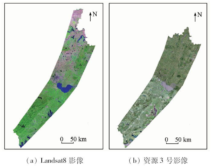
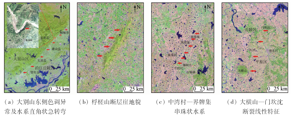
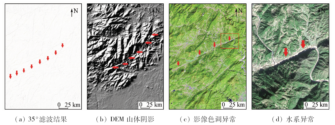
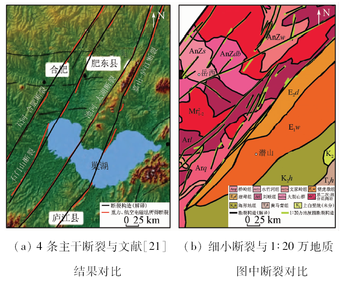
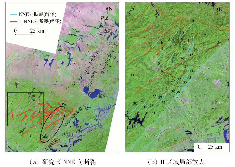
In the previous study of the Anhui segment of Tanlu fault zone, it is generally believed that the Anhui segment of Tanlu fault zone is composed of the Wuhe-Hefei fault, the Shimenshan fault, the Chihe-Taihu fault and the Jiashan-Lujiang fault. However, there is no comprehensive and systematic research on the exact boundary position of the fault zone, especially the boundary of the Dabie Mountain in the southern part of the Anhui segment of the Tanlu fault zone. In view of such a situation, based on the multi-source data such as Landsat 8 OLI, ZY-3 and DEM data, the authors comprehensively utilized GIS spatial analysis and spatial statistics to perform remote sensing interpretation of the Anhui segment of Tanlu fault zone and statistical analysis of the interpretation results. The analysis shows the more accurate boundary range of the Anhui segment of Tanlu fault zone. The existing geological data prove that the boundary range is reasonable and reliable to some extent. The study shows that the spatial distribution characteristics of the north and south sections of the Anhui segment of Tanlu fault zone are different. The average trend of the northern section is about N23.5°E, the average width is about 25.99 km, the average trend of the southern section is about N34.9°E, and the average width is about 38.38 km, the overall trend of the whole Anhui segment of Tanlu fault zone is about N33.3°E, with an average width about 30.35 km. The fault zone presents a spatial distribution pattern of “short in the north and long in the south”, “ wide in the south and narrow in the north” and “the fault trend progressively moving northward from south to north”. The research results can provide an important reference for urban planning, engineering construction and geological disaster prevention within the Anhui segment of Tanlu fault zone.

Key wordsTanlu fault zone    remote sensing    multi-source data    spatial analysis
收稿日期: 2018-08-29      出版日期: 2019-12-03
:  TP79  
基金资助:国家自然科学基金资助项目“基岩裂隙水非达西流条件下非费克运移试验与模型研究”(41272251);安徽省自然科学基金资助项目“基于新型DEM的江淮平原区微地貌数字地形表达方法研究”(1508085MD62);虚拟地理环境教育部重点实验室开放基金资助项目“基于DEM的梯田地形对自然地表水文过程的扰动研究”(2012VGE04);安徽省国土资源科技项目“淮南煤田采煤塌陷的演变规律及预测预警预报技术研究”(2012AHST0802);安徽省公益性地质调查重点项目“郯庐断裂带安徽段地质环境调查评价”共同资助(2015-g-26)
作者简介: 赵卫东(1969-),男,博士,副教授,硕士生导师,主要从事3S技术在资源与环境领域中的应用研究。Email: zhaowd@hfut.edu.cn。
引用本文:   
赵卫东, 郑勇, 章浩南, 姜琼, 卫佳佳. 基于多源数据的郯庐断裂带安徽段遥感解译及其空间分布特征[J]. 国土资源遥感, 2019, 31(4): 79-87.
Weidong ZHAO, Yong ZHENG, Haonan ZHANG, Qiong JIANG, Jiajia WEI. Remote sensing interpretation and spatial distribution characteristics of the Anhui segment of Tanlu fault zone based on multi-source data. Remote Sensing for Land & Resources, 2019, 31(4): 79-87.
链接本文:  
https://www.gtzyyg.com/CN/10.6046/gtzyyg.2019.04.11      或      https://www.gtzyyg.com/CN/Y2019/V31/I4/79
Fig.1  郯庐断裂带安徽段地貌及构造简图
Fig.2  研究区遥感影像
断裂解译标志 主要内容
水平解译标志 色调 由于断裂两侧地层、构造不同而形成不同色调分界线,2种不同色调分界面呈线状延伸,如在地貌单元上表现为平原与丘陵、平原与山地的分界线等
水系 水系局部河段出现异常,如直角状急转弯、直线和折线河段,长而直的峡谷,水系呈现串珠状排列或呈线状分布
植被 植被稀少带、茂盛带或生长异常带,有规律分布
垂直解译标志 山脊线 山脊线等地貌要素的错动呈线状排列
低洼地形 低洼地形如线状沟谷等呈线状分布,且具有明显方向性
断层三角面 一系列断层三角面整齐排布,断层三角面在影像上常表现为暗色调阴影
综合景观 断裂两侧的色调、地貌、水系、纹理、植被以及DEM等综合景观存在差异
Tab.1  郯庐断裂带安徽段断裂构造解译标志(据文献[20]修改)
Fig.3  遥感解译技术流程
Fig.4  池河—太湖断裂遥感解译影像
Fig.5  大别山区域细小断裂遥感解译
Fig.6  遥感解译断裂结果对比
断裂名称 断裂走向(NNE向)
五河—合肥断裂 21.8
石门山断裂 21.2
池河—太湖断裂 31.2
嘉山—庐江断裂 20.1
黄梅断裂 44.2
Tab.2  郯庐断裂带主干断裂总体走向
Fig.7  研究区断裂构造解译结果
断裂编号 断裂走向 断裂编号 断裂走向 断裂编号 断裂走向 断裂编号 断裂走向
1 4.0 5 35.6 9 31.4 13 14.1
2 25.8 6 20.1 10 38.3
3 19.8 7 2.3 11 0.3
4 24.7 8 33.5 12 6.7
Tab.3  Ⅰ区域内NNE向断裂统计
断裂编号 断裂走向 断裂编号 断裂走向 断裂编号 断裂走向 断裂编号 断裂走向
1 44.4 11 35.2 21 40.6 31 24.5
2 27.7 12 38.7 22 34.4 32 25.6
3 13.9 13 4.5 23 39.1 33 6.7
4 21.1 14 35.3 24 34.4 34 29.8
5 44.7 15 31.9 25 40.1 35 37.7
6 36.3 16 12.4 26 26.7 36 39.1
7 44.4 17 29.4 27 30.6 37 39.3
8 28.1 18 28.4 28 20.6 38 36.5
9 28.0 19 27.3 29 43.6 39 33.2
10 7.5 20 18.7 30 25.6 40 39.9
Tab.4  Ⅱ区域内NNE向断裂统计
Fig.8  郯庐断裂带安徽段空间分布
分段区域 东界位置 西界位置 所包含断裂 平均长
度/km
平均宽
度/km
平均走向/
(°)
面积/ km2
北段(嘉山—庐江段) 嘉山—庐江断裂 五河—合肥断裂 五河—合肥断裂、石门山断裂、池河—太湖断裂、嘉山—庐江断裂 261.09 25.99 23.5 6 544.17
南段(庐江—宿松段) 嘉山—庐江断裂与黄梅断裂安徽段的连接线 大别山区NNE向断裂密集区 池河—太湖断裂、黄梅断裂以及大别山区的40条NNE向次级断裂 136.74 38.38 34.9 4 564.95
全段合计 397.83 30.35 33.3 11 109.12
Tab.5  郯庐断裂带安徽段分段及整体统计信息
[1] 安徽省地质矿产局. 安徽省区域地质志[M]. 北京: 地质出版社, 1987: 501-507.
Anhui Provincial Bureau of Geology and Mineral Resources. Regional Geology of Anhui Province[M]. Beijing: Geological Publishing House, 1987: 501-507.
[2] 张交东, 杨长春, 刘成斋 , 等. 郊庐断裂南段走滑和伸展断裂的深部结构及位置关系[J]. 地球物理学报, 2010,53(4):864-873.
doi: 10.3969/j.issn.0001-5733.2010.04.011
Zhang J D, Yang C C, Liu C Z , et al. The deep structures of strike-slip and extension faults and their composite relationship in the southern segment of Tanlu fault zone[J]. Chinese Journal of Geophysics, 2010,53(4):864-873.
[3] Xu J W, Zhu G, Tong W X , et al. Formation and evolution of the Tancheng-Lujiang wrench fault system:A major shear system to the northern of the Pacific Ocean[J]. Tectonophysics, 1987,134(4):273-310.
[4] Xu J W, Zhu G . Tectonic models of the Tan-Lu fault zone,eastern China[J]. International Geology Review, 1994,36(8):771-784.
[5] 国家地震局地质研究所. 郯庐断裂[M]. 北京: 地震出版社, 1987.
Institute of Geology State Seismological Bureau. Tanlu Fault[M]. Beijing: Seismological Press, 1987.
[6] 徐嘉炜, 马国锋 . 郯庐断裂带研究的十年回顾[J]. 地质论评, 1992,38(4):316-324.
Xu J W, Ma G F . Review of the years (1981—1991) of research on the Tancheng-Lujiang fault zone[J]. Geological Review, 1992,38(4):316-324.
[7] 魏光兴, 刁守中, 周翠英 . 郯庐带地震活动性研究[M]. 北京: 地震出版社, 1993.
Wei G X, Diao S Z, Zhou C Y. Study of Seismicity Along the Tancheng-Lujiang Seismic Zone[M]. Beijing: Seismological Press, 1993.
[8] 赵田, 朱光, 林少泽 , 等. 郯庐断裂带张八岭隆起段变质岩的原岩时代与变形机制[J]. 中国科学(地球科学), 2014,44(10):2112-2129.
Zhao T, Zhu G, Lin S Z , et al. Protolith ages and deformation mechanism of metamorphic rocks in the Zhangbaling uplift segment of the Tan-Lu fault zone[J]. Science China(Earth Sciences), 2014,44(10):2112-2129.
[9] 汤家富, 李怀坤, 娄清 . 郯庐断裂南段研究进展与断裂性质讨论[J]. 地质通报, 2003,22(6):426-436.
Tang J F, Li H K, Lou Q . Progress in the study of the southern segment of the Tanlu fault and a discussion of the nature of the fault[J]. Geological Bulletin of China, 2003,22(6):426-436.
[10] 李云平, 吴时国, 韩文功 , 等. 合肥盆地和郯庐断裂带南段深部地球物理特征研究[J]. 地球物理学报, 2006,49(1):115-122.
Li Y P, Wu S G, Han W G , et al. A study on geophysical features of deep structures of the Hefei Basin and the southern Tan-Lu fault zone[J]. Chinese Journal of Geophysics, 2006,49(1):115-122.
[11] 聂峰, 石永红, 张忠宝 , 等. 安徽北部郯庐断裂两侧基底岩石年龄及对郯庐断裂初始开启时间的限定[J]. 科学通报, 2015,60(24):2315-2326.
Nie F, Shi Y H, Zhang Z B , et al. The initial time of the Tan-Lu wrench fault:In the view of geochronological data of the basement rocks,northern Anhui Province[J]. Chinese Science Bulletin, 2015,60(24):2315-2326.
[12] 芮柏 . 对苏皖断裂带的初步研究(郯—庐断裂研究之二)[J]. 华东地质学院学报, 1988,11(1):1-10.
Rui B . The preliminary study on the Su-Wan fault zone (two that studied Tan Lu fault zone)[J]. Journal of East China College of Geology, 1988,11(1):1-10.
[13] 宋传中, 王国强, 朱光 , 等. 郯庐断裂带桐城—庐江段的构造特征及演化[J]. 安徽地质, 1998,8(4):37-40.
Song C Z, Wang G Q, Zhu G , et al. Structural characteristics and evolution of the Tongcheng to Lujiang section of the Tan Lu fault zone[J]. Geology of Anhui, 1998,8(4):37-40.
[14] 王小凤 . 郯庐断裂带[M]. 北京: 地质出版社, 2000.
Wang X F. Tan-Lu Fault Zone[M]. Beijing: Geological Publishing House, 2000.
[15] 徐嘉炜 . 徐嘉炜论郯庐断裂带(论文选集)[M]. 合肥: 合肥工业大学出版社, 2015.
Xu J W. Xu Jiawei on Tan Lu Fault Zone(Selected Papers)[M]. Hefei: Hefei University of Technology Press, 2015.
[16] 侯明金, 王永敏, Mercier J , 等. 郯庐断裂带(安徽部分)动力学演化及其构造意义[J]. 地质通报, 2003,22(2):105-112.
Hou M J, Wang Y M, Mercier J , et al. Dynamic of the evolution and tectonic significance Tanlu fault zone(Anhui segment)[J]. Geological Bulletin of China, 2003,22(2):105-112.
[17] 赵英时 . 遥感应用分析原理与方法[M]. 北京: 科学出版社, 2003.
Zhao Y S. Principles and Methods of Remote Sensing Application Analysis[M]. Beijing: Science Press, 2003.
[18] 齐信, 邵长生, 陈州丰 , 等. 多源遥感数据在断裂构造解译中的应用[J]. 大地测量与地球动力学, 2012,32(4):90-93.
Qi X, Shao C S, Chen Z F , et al. Application of Multi-source remote sensing date in fault structure interretation[J]. Journal of Geo-desy and Geodynamics, 2012,32(4):90-93.
[19] Sabins F F . Remote Sensing:Principles and Interpretation[M]. New York:W.H.Freeman and Company, 1997.
[20] 杨韫澜, 韩玲, 韩晓勇 , 等. 基于资源三号和ETM+影像的断裂构造解译[J]. 地理空间信息, 2014,12(5):17-19.
Yang Y L, Han L, Han X Y , et al. Fracture structure interpretation based on ZY-3 and ETM+[J]. Geospatial Information, 2014,12(5):17-19.
[21] 王鑫, 张景发, 姜文亮 , 等. 郯庐断裂带南段重力异常及不同深度的横向构造特征[J]. 地震地质, 2016,38(2):370-385.
doi: 10.3969/j.issn.0253-4967.2016.02.011
Wang X, Zhang J F, Jiang W L , et al. Transverse structures features of different depths derived from bouguer gravity anomalies in the southern segment of Tan-Lu fault zone[J]. Seismology and Geolo-gy, 2016,38(2):370-385.
[22] 姚大全, 汤有标, 刘加灿 , 等. 大别山东北部基岩区断裂活动习性的综合研究[J]. 地震地质, 1999,21(1):63-68.
Yao D Q, Tang Y B, Liu J C , et al. A synthetical study on active behavior of fault in bedrock area of northeastern Dabie Mountain[J]. Seismology and Geology, 1999,21(1):63-68.
[23] 张交东, 刘德良, 林会喜 , 等. 郯庐断裂带南段巨型正花状构造的发现及地质意义[J]. 中国科学技术大学学报, 2003,33(4):486-490.
Zhang J D, Liu D L, Lin H X , et al. Discovery of the giant positive-flower-structure in the southern part of Tanlu fault and it’s geological significance[J]. Journal of University of Science and Technology of China, 2003,33(4):486-490.
[1] 刘文, 王猛, 宋班, 余天彬, 黄细超, 江煜, 孙渝江. 基于光学遥感技术的冰崩隐患遥感调查及链式结构研究——以西藏自治区藏东南地区为例[J]. 自然资源遥感, 2022, 34(1): 265-276.
[2] 王茜, 任广利. 高光谱遥感异常信息在阿尔金索拉克地区铜金矿找矿工作中的应用[J]. 自然资源遥感, 2022, 34(1): 277-285.
[3] 吕品, 熊丽媛, 徐争强, 周学铖. 基于FME的矿山遥感监测矢量数据图属一致性检查方法[J]. 自然资源遥感, 2022, 34(1): 293-298.
[4] 张大明, 张学勇, 李璐, 刘华勇. 一种超像素上Parzen窗密度估计的遥感图像分割方法[J]. 自然资源遥感, 2022, 34(1): 53-60.
[5] 薛白, 王懿哲, 刘书含, 岳明宇, 王艺颖, 赵世湖. 基于孪生注意力网络的高分辨率遥感影像变化检测[J]. 自然资源遥感, 2022, 34(1): 61-66.
[6] 宋仁波, 朱瑜馨, 郭仁杰, 赵鹏飞, 赵珂馨, 朱洁, 陈颖. 基于多源数据集成的城市建筑物三维建模方法[J]. 自然资源遥感, 2022, 34(1): 93-105.
[7] 李伟光, 侯美亭. 植被遥感时间序列数据重建方法简述及示例分析[J]. 自然资源遥感, 2022, 34(1): 1-9.
[8] 丁波, 李伟, 胡克. 基于同期光学与微波遥感的茅尾海及其入海口水体悬浮物反演[J]. 自然资源遥感, 2022, 34(1): 10-17.
[9] 吴琳琳, 李晓燕, 毛德华, 王宗明. 基于遥感和多源地理数据的城市土地利用分类[J]. 自然资源遥感, 2022, 34(1): 127-134.
[10] 高琪, 王玉珍, 冯春晖, 马自强, 柳维扬, 彭杰, 季彦桢. 基于改进型光谱指数的荒漠土壤水分遥感反演[J]. 自然资源遥感, 2022, 34(1): 142-150.
[11] 秦大辉, 杨灵, 谌伦超, 段云飞, 贾宏亮, 李贞培, 马建琴. 基于多源数据的新疆干旱特征及干旱模型研究[J]. 自然资源遥感, 2022, 34(1): 151-157.
[12] 张秦瑞, 赵良军, 林国军, 万虹麟. 改进遥感生态指数的宜宾市三江汇合区生态环境评价[J]. 自然资源遥感, 2022, 34(1): 230-237.
[13] 贺鹏, 童立强, 郭兆成, 涂杰楠, 王根厚. 基于地形起伏度的冰湖溃决隐患研究——以希夏邦马峰东部为例[J]. 自然资源遥感, 2022, 34(1): 257-264.
[14] 于新莉, 宋妍, 杨淼, 黄磊, 张艳杰. 结合空间约束的卷积神经网络多模型多尺度船企场景识别[J]. 自然资源遥感, 2021, 33(4): 72-81.
[15] 李轶鲲, 杨洋, 杨树文, 王子浩. 耦合模糊C均值聚类和贝叶斯网络的遥感影像后验概率空间变化向量分析[J]. 自然资源遥感, 2021, 33(4): 82-88.
Viewed
Full text


Abstract

Cited

  Shared   
  Discussed   
京ICP备05055290号-2
版权所有 © 2015 《自然资源遥感》编辑部
地址:北京学院路31号中国国土资源航空物探遥感中心 邮编:100083
电话:010-62060291/62060292 E-mail:zrzyyg@163.com
本系统由北京玛格泰克科技发展有限公司设计开发