Remote sensing-based mineralized alteration information extraction and prospecting prediction of the Beiya gold deposit, Yunnan Province
WEI Yingjuan1(), LIU Huan2
1. Land Satellite Remote Sensing Application Center, Beijing 100048, China 2. Institute of Mineral Resources, Chinese Academy of Geological Sciences, Beijing 100037, China
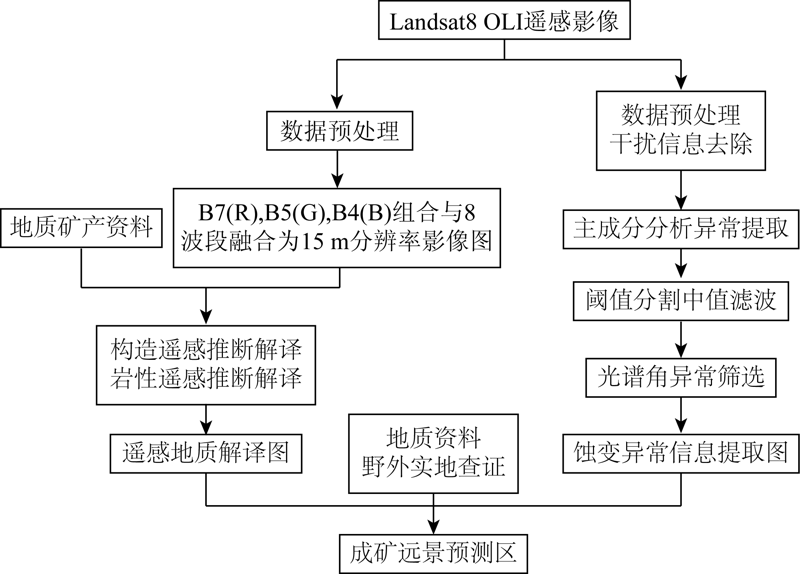
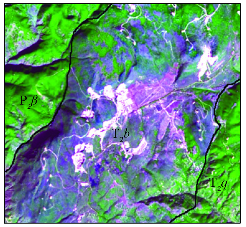
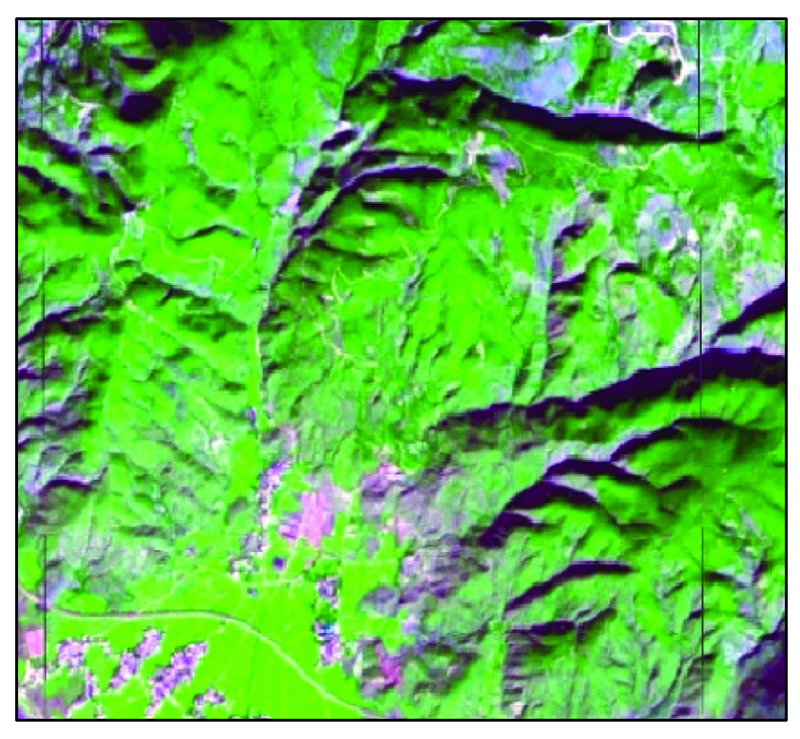
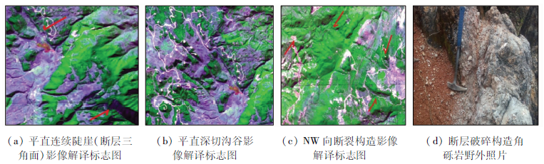
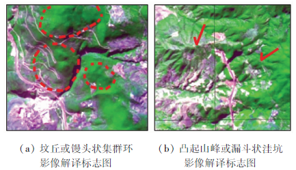
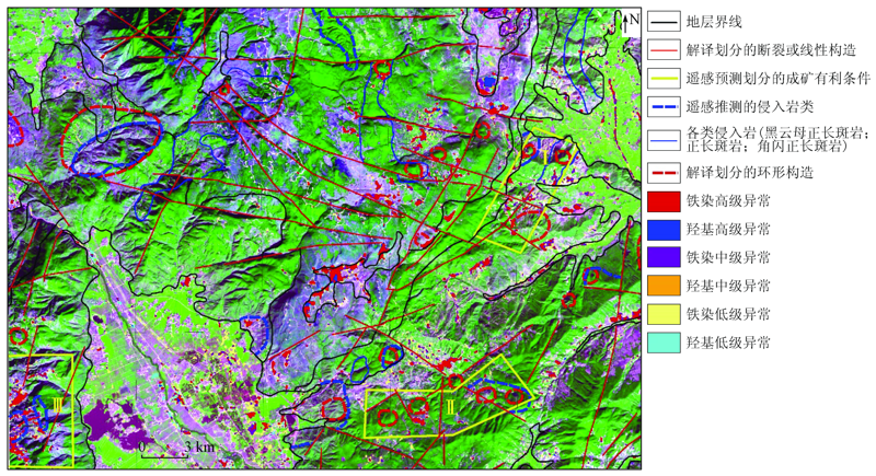
The identification and extraction of mineralized alteration information play an important role in the ore prospecting using remote sensing technology. Taking the Beiya gold polymetallic deposit as an example, this study designed an alteration information extraction scheme using the principal component analysis technique according to Landsat8 OLI data and the spectral characteristics related to mineral alteration. Specifically, the extraction scheme consists of the removal of interference information (vegetation, water, and shadows), extraction of abnormal information, anomaly gradation, median filtering, and anomaly screening successively. According to the anomaly information extracted, as well as geological interpretation of remote sensing data (lithology and structures) and field surveys, three prospecting areas were delineated in the study area. This will provide basic data and decision-making bases for the ore prospecting in the Beiya area.
Zhang B, Zheng Y, Li Q Y, et al. Remote sensing anomaly information extraction method based on OLI remote sensing data[J]. Journal of Henan University of Technology, 2017, 36(3):47-53.
Chen A B, Sun C X, Jiang H, et al. Comprehensive information and metalorganic prediction of Beiya gold deposit[J]. Geology and Prospecting, 2011, 47(4):663-641.
Yang S Y, Wang R X. Comprehensive remote sensing geological information of Beiya alkaline porphyry gold deposit[J]. Journal of Kunming University of Science and Technology, 2002, 27(4):1-5.
Yang J M, Zhang Y J, et al. A modern technical method for mineral resources survey and evaluation:A multi-information mineral evaluation method led by ETM+ alteration remote sensing anomalies[J]. Mineral Deposits, 2002, 21(s1):1225-1227.
Yao F J, Zhang Y J, Yang J M, et al. Extracting remote sensing alteration zoning information of Dexing porphyry copper deposit using ASTER[J]. Mineral Deposits, 2012, 31(4):881-890.
Zhang Y J, Zeng C M. Study on the best multi-spectral remote sensing anomaly criterion for the identification of porphyry copper deposits in Gangdise area,Tibet[J]. Mineral Deposits, 2012, 31(4):671-698.
Zhang G R, Lu Q S, Fei Y Q. Application of ETM+ data in the extraction of alteration remote sensing anomaly information in Heicigou,Subei County,Gansu Province[J]. Tectonics and Metallogeny, 2010, 34(3):386-390.
Fei Y Q, Li Y Q. Alteration remote sensing anomaly information extraction and metallogenic area prediction based on ETM data:Taking Gansu Dang and Nanshan area as an example[J]. Remote Sensing Technology and Application, 2011, 26(4):482-488.
Wang Y W, Xie Q X, He X F, et al. Remote sensing anomaly information extraction and mineralization prediction of Amuwusu,Beishan,Inner Mongolia[J]. Journal of Sichuan Geology, 2015, 35(1):151-156.
Fu H B. Remote sensing anomaly information extraction based on spectral angle mapping method[J]. Surveying and Spatial Geographic Information, 2011, 34(6):82-84.
 2021, Vol. 33
  ), 刘欢2