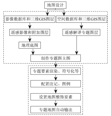
地质灾害三维遥感解译成果的自动制图方法
 , 马维峰, 唐湘丹
Automatic mapping of the results of 3D remote sensing interpretation of geological disasters
ZHANG Mingyang1 , MA Weifeng1 , TANG Xiangdan2 , LI Xianwei2
, MA Weifeng, TANG Xiangdan