高光谱与LiDAR数据融合研究——以黑河中游张掖绿洲农业区精细作物分类为例
Fusion of hyperspectral and LiDAR data: A case study for refined crop classification in agricultural region of Zhangye Oasis in the middle reaches of Heihe River
高光谱与LiDAR数据融合研究——以黑河中游张掖绿洲农业区精细作物分类为例 |
| 杨思睿, 薛朝辉, 张玲, 苏红军, 周绍光 |
|
Fusion of hyperspectral and LiDAR data: A case study for refined crop classification in agricultural region of Zhangye Oasis in the middle reaches of Heihe River |
| Sirui YANG, Zhaohui XUE, Ling ZHANG, Hongjun SU, Shaoguang ZHOU |
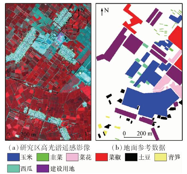
| 图2 研究区高光谱遥感影像与地面参考数据[ |
| Fig.2 Hyperspectral remote sensing image and ground reference data[ |
|
|