基于系留无人机的应急测绘技术应用
Tethered UAVs-based applications in emergency surveying and mapping
基于系留无人机的应急测绘技术应用 |
| 王永全, 李清泉, 汪驰升, 朱家松, 王新雨 |
|
Tethered UAVs-based applications in emergency surveying and mapping |
| Yongquan WANG, Qingquan LI, Chisheng WANG, Jiasong ZHU, Xinyu WANG |
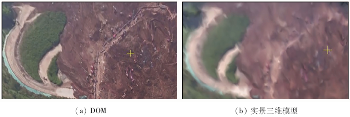
| 图1 深圳光明新区山体垮塌区域DOM及实景三维模型 |
| Fig.1 DOM and real-life 3D model of the collapsed area of the Guangming New District, Shenzhen |
|
|