基于无人机影像的喀斯特农耕区地物识别——以桂林市为例
Object recognition of karst farming area based on UAV image: A case study of Guilin
基于无人机影像的喀斯特农耕区地物识别——以桂林市为例 |
| 娄佩卿, 陈晓雨, 王疏桐, 付波霖, 黄永怡, 唐廷元, 凌铭 |
|
Object recognition of karst farming area based on UAV image: A case study of Guilin |
| Peiqing LOU, Xiaoyu CHEN, Shutong WANG, Bolin FU, Yongyi HUANG, Tingyuan TANG, Ming LING |
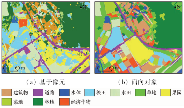
| 图7 耕地+居民地复合区分类结果对比 |
| Fig.7 Comparison between the classification results of cultivated land and residential compound area and the original image |
|
|