基于Landsat8卫星影像土地利用景观破碎化研究——以陕西省延安麻塔流域为例
A study of the landscape fragmentations of land cover structure based on Landsat8 remote sensing image: A case study of Mata watershed in Yan’an, Shaanxi Province
基于Landsat8卫星影像土地利用景观破碎化研究——以陕西省延安麻塔流域为例 |
| 李国庆, 黄菁华, 刘冠, 李洁, 翟博超, 杜盛 |
|
A study of the landscape fragmentations of land cover structure based on Landsat8 remote sensing image: A case study of Mata watershed in Yan’an, Shaanxi Province |
| LI Guoqing, HUANG Jinghua, LIU Guan, LI Jie, ZHAI Bochao, DU Sheng |
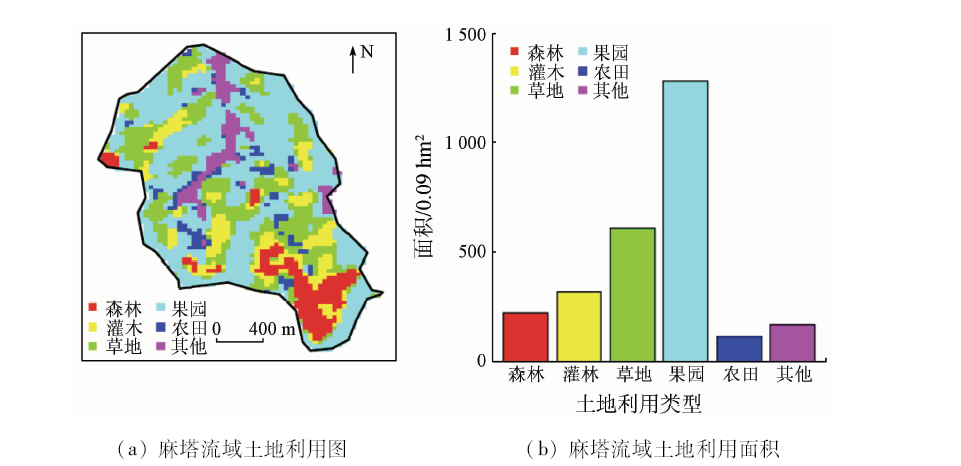
| 图3 麻塔流域土地利用图及其对应面积分布 |
| Fig.3 Land covers map and their corresponding area size in mata watershed |
|
|