多源卫星测高数据监测太湖水位变化及影响分析
魏浩翰1( ), 许仁杰1, 杨强1, 周权平2
), 许仁杰1, 杨强1, 周权平2
Variation and effect analysis of the water level of the Taihu Lake based on multi-source satellite altimetry data
WEI Haohan1(), XU Renjie1, YANG Qiang1, ZHOU Quanping2
), XU Renjie1, YANG Qiang1, ZHOU Quanping2
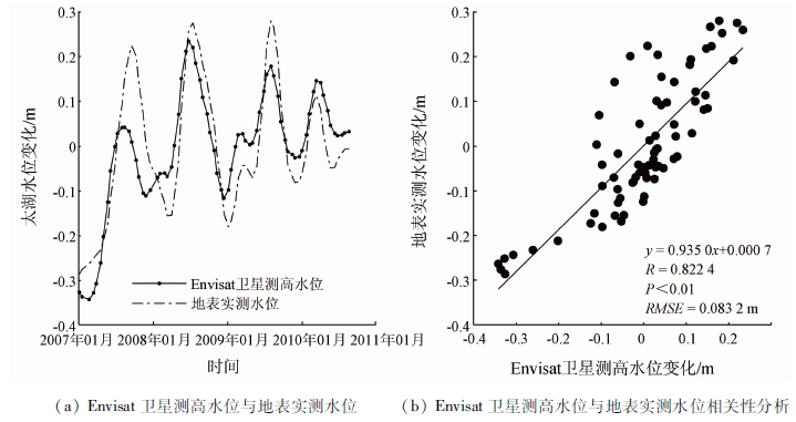
图2. Envisat卫星测高水位与地表实测水位对比
Fig.2. Comparison of Envisat satellite altimetry water level and surface measured water level