多源卫星测高数据监测太湖水位变化及影响分析
魏浩翰1( ), 许仁杰1, 杨强1, 周权平2
), 许仁杰1, 杨强1, 周权平2
Variation and effect analysis of the water level of the Taihu Lake based on multi-source satellite altimetry data
WEI Haohan1(), XU Renjie1, YANG Qiang1, ZHOU Quanping2
), XU Renjie1, YANG Qiang1, ZHOU Quanping2
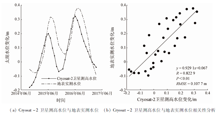
图3. Cryosat-2卫星测高水位与地表实测水位对比
Fig.3. Comparison of Cryosat-2 satellite altimetry water level and surface measured water level