基于多尺度LBP特征融合的遥感图像分类
姜亚楠1( ), 张欣2, 张春雷3, 仲诚诚1, 赵俊芳1
), 张欣2, 张春雷3, 仲诚诚1, 赵俊芳1
Classification of remote sensing images based on multi-scale feature fusion using local binary patterns
JIANG Yanan1(), ZHANG Xin2, ZHANG Chunlei3, ZHONG Chengcheng1, ZHAO Junfang1
), ZHANG Xin2, ZHANG Chunlei3, ZHONG Chengcheng1, ZHAO Junfang1
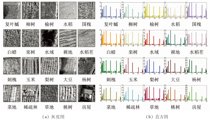
图6. 选取PCA01下20类地物的灰度图及LB
Fig.6. Grayscale image and LB