基于无人机低空遥感和现场调查的潮滩地形反演研究
李阳1( ), 袁琳1,2(), 赵志远1, 张晋磊1, 王宪业1, 张利权1
), 袁琳1,2(), 赵志远1, 张晋磊1, 王宪业1, 张利权1
Inversion of tidal flat topography based on unmanned aerial vehicle low-altitude remote sensing and field surveys
LI Yang1(), YUAN Lin1,2(), ZHAO Zhiyuan1, ZHANG Jinlei1, WANG Xianye1, ZHANG Liquan1
), YUAN Lin1,2(), ZHAO Zhiyuan1, ZHANG Jinlei1, WANG Xianye1, ZHANG Liquan1
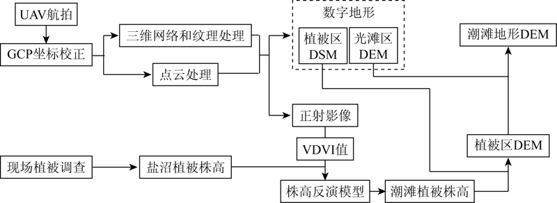
图7. 潮滩地形测量流程
Fig.7. Flow chart of tidal flat topographic reconstruction