一种基于GEE平台制作逐年土地覆盖数据的方法——以黄河流域为例
方梦阳1( ), 刘晓煌2, 孔凡全1, 李明哲1, 裴小龙3
), 刘晓煌2, 孔凡全1, 李明哲1, 裴小龙3
A method for creating annual land cover data based on Google Earth Engine: A case study of the Yellow River basin
FANG Mengyang1(), LIU Xiaohuang2, KONG Fanquan1, LI Mingzhe1, PEI Xiaolong3
), LIU Xiaohuang2, KONG Fanquan1, LI Mingzhe1, PEI Xiaolong3
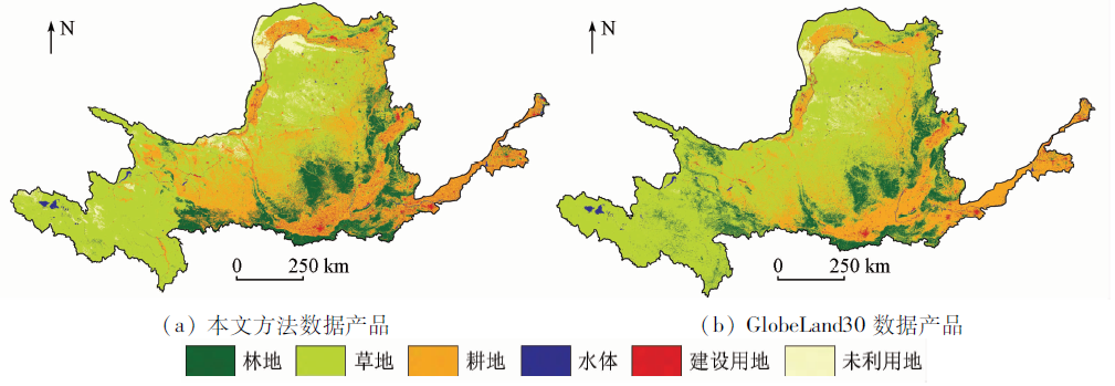
图4-1. 黄河流域2010年土地覆盖分类图
Fig.4-1. Land cover classification map of the Yellow River basin in 2010