甘肃金川矿区地表三维形变InSAR监测
杨旺1,2,3( ), 何毅1,2,3(), 张立峰1,2,3, 王文辉1,2,3, 陈有东1,2,3, 陈毅1,2,3
), 何毅1,2,3(), 张立峰1,2,3, 王文辉1,2,3, 陈有东1,2,3, 陈毅1,2,3
InSAR monitoring of 3D surface deformation in Jinchuan mining area, Gansu Province
YANG Wang1,2,3(), HE Yi1,2,3(), ZHANG Lifeng1,2,3, WANG Wenhui1,2,3, CHEN Youdong1,2,3, CHEN Yi1,2,3
), HE Yi1,2,3(), ZHANG Lifeng1,2,3, WANG Wenhui1,2,3, CHEN Youdong1,2,3, CHEN Yi1,2,3
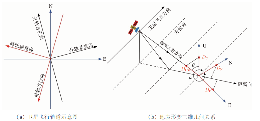
图4. SAR卫星飞行方向和地表形变三维几何关系
Fig.4. Satellite flight direction and 3D geometric relationship of land deformation