基于1990—2019年Landsat影像的干旱区绿洲土地利用变化与模拟
宋奇1( ), 冯春晖1, 马自强2, 王楠3, 纪文君4, 彭杰1()
), 冯春晖1, 马自强2, 王楠3, 纪文君4, 彭杰1()
Simulation of land use change in oasis of arid areas based on Landsat images from 1990 to 2019
SONG Qi1(), FENG Chunhui1, MA Ziqiang2, WANG Nan3, JI Wenjun4, PENG Jie1()
), FENG Chunhui1, MA Ziqiang2, WANG Nan3, JI Wenjun4, PENG Jie1()
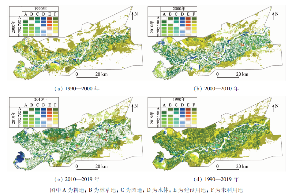
图9. 阿拉尔垦区在不同时间段的土地利用动态变化
Fig.9. Dynamic changes of land use in Alar reclamation area in different time periods