基于1990—2019年Landsat影像的干旱区绿洲土地利用变化与模拟
Simulation of land use change in oasis of arid areas based on Landsat images from 1990 to 2019
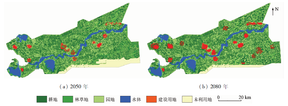
图11. 阿拉尔垦区2050年和2080年的土地利用模拟情况
Fig.11. Land use simulation situation of Alar reclamation area in 2050 and 2080

