基于1990—2019年Landsat影像的干旱区绿洲土地利用变化与模拟
Simulation of land use change in oasis of arid areas based on Landsat images from 1990 to 2019
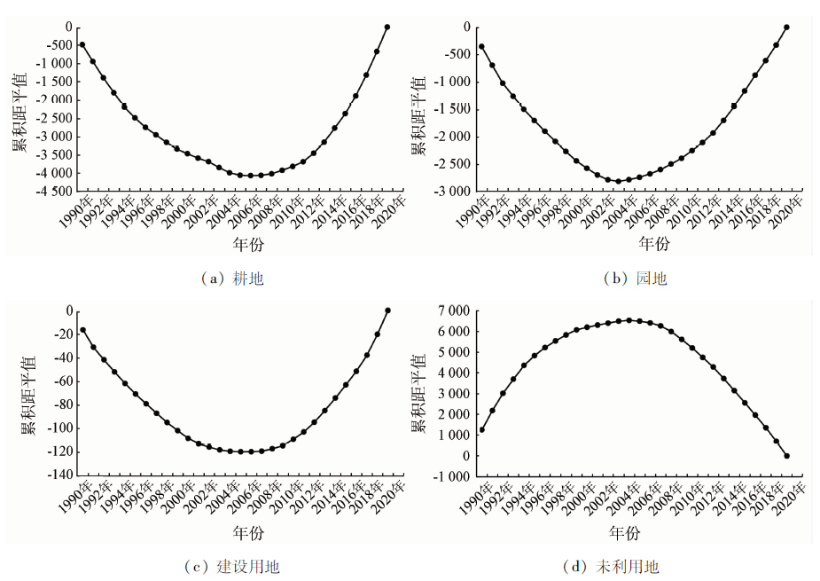
图12. 阿拉尔垦区土地利用类型面积变化的突变情况分析
Fig.12. Analysis on the abrupt change of land use type area in Alar reclamation area

