基于光学遥感技术的冰崩隐患遥感调查及链式结构研究——以西藏自治区藏东南地区为例
刘文( ), 王猛(), 宋班, 余天彬, 黄细超, 江煜, 孙渝江
), 王猛(), 宋班, 余天彬, 黄细超, 江煜, 孙渝江
Surveys and chain structure study of potential hazards of ice avalanches based on optical remote sensing technology: A case study of southeast Tibet
LIU Wen(), WANG Meng(), SONG Ban, YU Tianbin, HUANG Xichao, JIANG Yu, SUN Yujiang
), WANG Meng(), SONG Ban, YU Tianbin, HUANG Xichao, JIANG Yu, SUN Yujiang
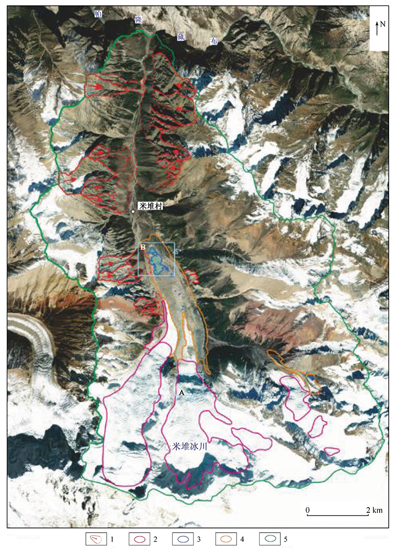
图2. 米堆沟遥感解译图
1.崩塌界线及主崩方向; 2.潜在冰崩体; 3.冰湖; 4.冰碛物; 5.流域界线
Fig.2. Remote sensing interpretation map of Miduigou