无人机三维地障信息提取技术应用于航空物探飞行轨迹规划
吴芳( ), 李瑜(), 金鼎坚, 李天祺, 郭华, 张琦洁
), 李瑜(), 金鼎坚, 李天祺, 郭华, 张琦洁
Application of 3D information extraction technology of ground obstacles in the flight trajectory planning of UAV airborne geophysical exploration
WU Fang(), LI Yu(), JIN Dingjian, LI Tianqi, GUO Hua, ZHANG Qijie
), LI Yu(), JIN Dingjian, LI Tianqi, GUO Hua, ZHANG Qijie
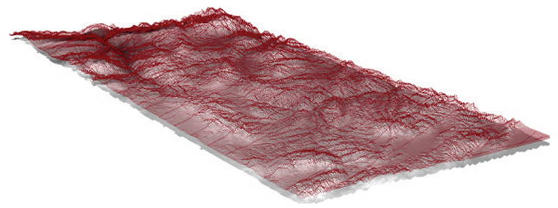
图5. 利用点云地形信息创建三维测网
Fig.5. Create a 3D survey network using the point cloud terrain information