地形及NDVI在林火遥感监测二次识别中应用的方法探讨
Methods for the application of topography and NDVI in re-identification of remote sensing-based monitoring of forest fires
地形及NDVI在林火遥感监测二次识别中应用的方法探讨 |
| 陈艳英, 马鑫程, 徐彦平, 王颖, 汪艳波 |
|
Methods for the application of topography and NDVI in re-identification of remote sensing-based monitoring of forest fires |
| CHEN Yanying, MA Xincheng, XU Yanping, WANG Ying, WANG Yanbo |
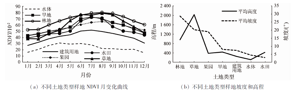
| 图1 不同土地类型样地NDVI月趋势线及对应坡度/高程值 |
| Fig.1 Monthly NDVI trend lines and slope/height values of different land types |
|
|