基于Landsat影像的鄱阳湖面积监测及其与水位关系研究
Monitoring of the area of Poyang Lake based on Landsat images and its relationship with the water level
基于Landsat影像的鄱阳湖面积监测及其与水位关系研究 |
| 赵辉, 陈振, 冯超帆, 张通, 赵学晶, 张兆旭 |
|
Monitoring of the area of Poyang Lake based on Landsat images and its relationship with the water level |
| ZHAO Hui, CHEN Zhen, FENG Chaofan, ZHANG Tong, ZHAO Xuejing, ZHANG Zhaoxu |
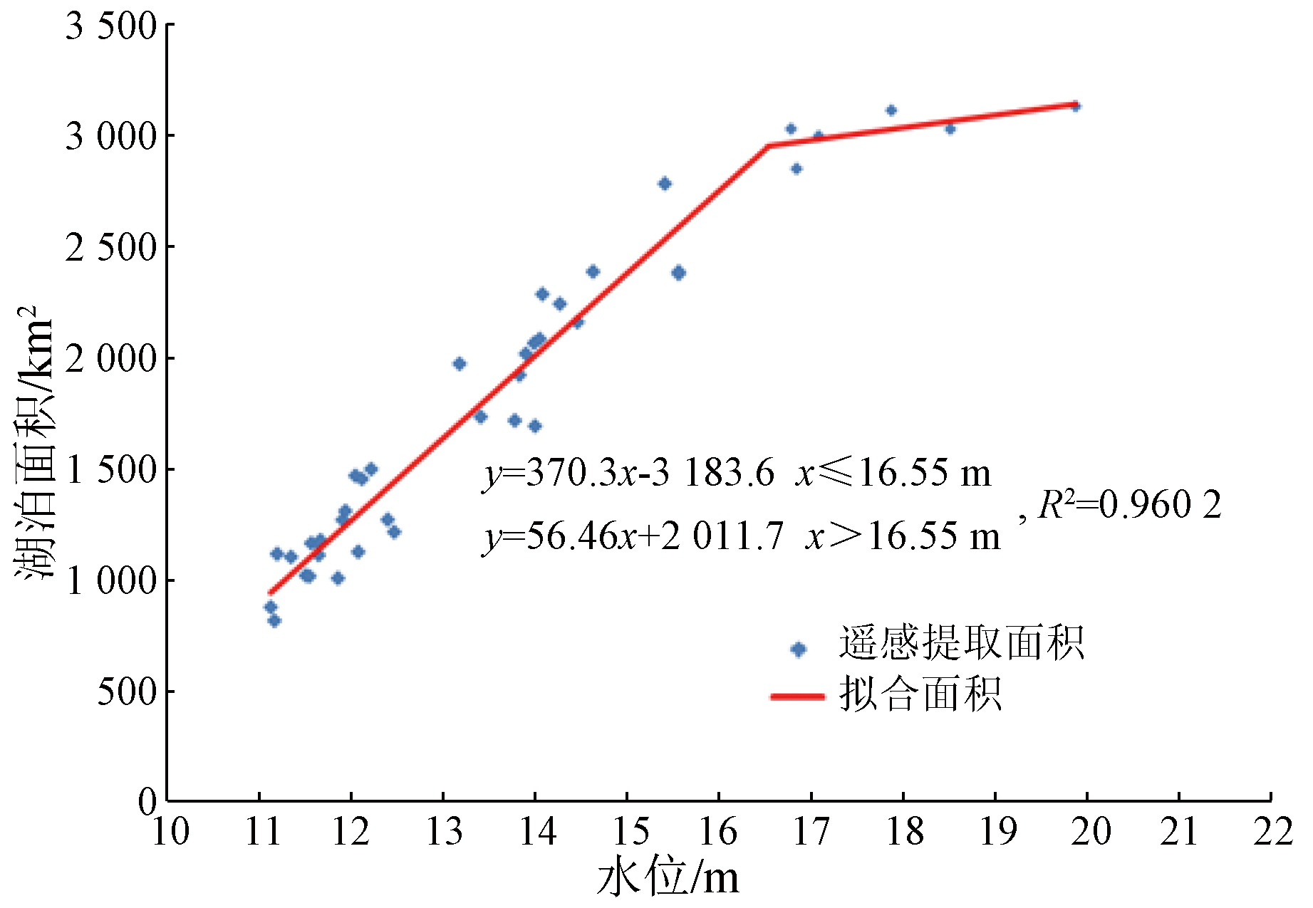
| 图6 棠荫站湖泊面积-水位分段线性模型拟合 |
| Fig.6 Fit plot of the piecewise linear model between the lake area and water level of Tangyin station |
|
|