浙江省宁波地区地质灾害隐患点遥感综合监测识别
Monitoring and identification of potential geological hazard sites using comprehensive remote sensing in Ningbo, Zhejiang Province
浙江省宁波地区地质灾害隐患点遥感综合监测识别 |
| 高峰, 张弘怀, 周伟, 王星星, 孙丽影, 许文新, 吴迪 |
|
Monitoring and identification of potential geological hazard sites using comprehensive remote sensing in Ningbo, Zhejiang Province |
| GAO Feng, ZHANG Honghuai, ZHOU Wei, WANG Xingxing, SUN Liying, XU Wenxin, WU Di |
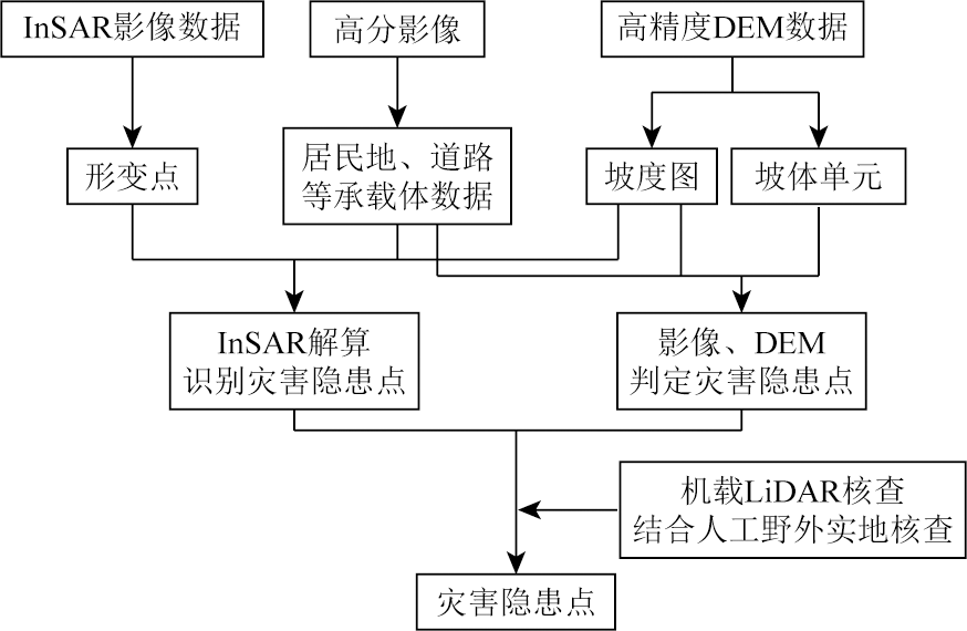
| 图2 集成InSAR、高分光学影像、无人机LiDAR的综合遥感滑坡灾害隐患点识别流程图 |
| Fig.2 Flowchart for integrating InSAR, high-resolution optical imagery, and UAV LiDAR for comprehensive remote sensing identification of landslide hazard points |
|
|