The application of UAV oblique photography in debris flow disaster identification and analysis:Taking the debris flow in Caojiafang, Shijiaying, Fangshan District, Beijing as an Example
YAN Chi(), JIAO Runcheng, CAO Ying, NAN Yun, WANG Shengyu, GUO Xuefei
Beijing Institute of Geology, Beijing 100120, China
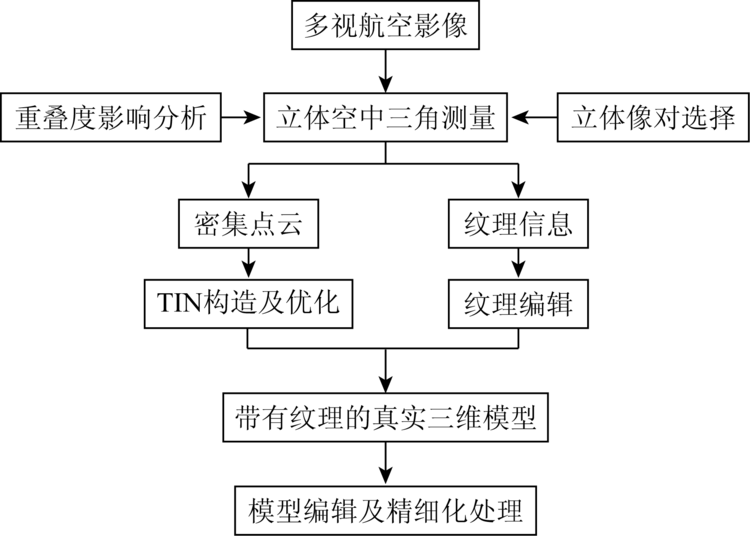
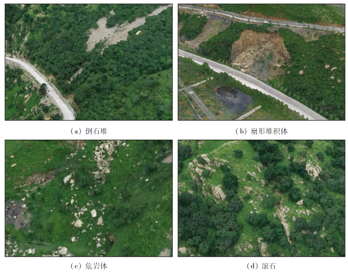
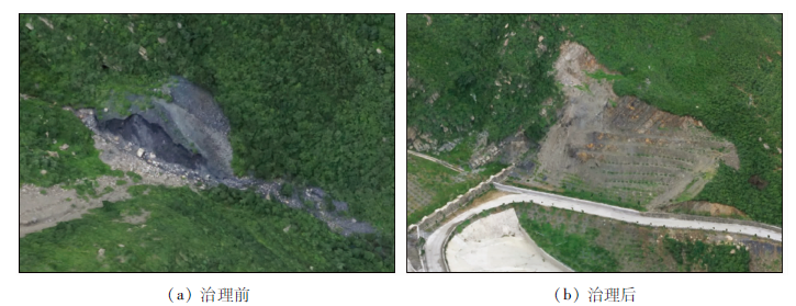
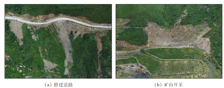
The traditional remote sensing survey method of debris flow is mainly orthophoto aerial photography, which has limitations in the accuracy and dimension of data acquisition. UAV tilt photography technology can simultaneously acquire images from different angles, such as vertical and tilt, obtain more complete and accurate information of ground objects, establish more intuitive three-dimensional model, and provide new technical means for geological disaster investigation. Taking the Caojiafang debris flow gully in Shijiaying as an example, the authors carried out the feature recognition analysis of debris flow disaster based on UAV tilt photogrammetry. It is believed that the high-precision three-dimensional model and texture details of debris flow gully can be obtained by incline photography, which can truly reflect the high-resolution information of the top and side of the real surface, and accurately obtain the distribution of debris flow material source and the estimation of material source volume; the data can be used to calculate the maximum amount of debris flow once washed out. This method can provide a more powerful means for the investigation of debris flow geological disasters and the assessment of current situation. The remote sensing technology can be fully used in the investigation and evaluation of debris flow disaster.
闫驰, 焦润成, 曹颖, 南赟, 王晟宇, 郭学飞. 无人机倾斜摄影在泥石流灾害识别分析中的应用——以北京房山区史家营曹家坊泥石流为例[J]. 国土资源遥感, 2020, 32(4): 251-257.
YAN Chi, JIAO Runcheng, CAO Ying, NAN Yun, WANG Shengyu, GUO Xuefei. The application of UAV oblique photography in debris flow disaster identification and analysis:Taking the debris flow in Caojiafang, Shijiaying, Fangshan District, Beijing as an Example. Remote Sensing for Land & Resources, 2020, 32(4): 251-257.
Yang J. The application of UAV tilt photography in three-dimensional visualization of geological hazards[J]. China Manganese Industry, 2017,35(2):38-43.
Wei Y M, Guo H D, Chen Y, et al. Remote sensing image characteristics of Zhouqu super-large debris flow in Gansu Province and geological significance of remote sensing identification of ancient debris flow[J]. Quaternary Study, 2014,34(2):28-33.
Wang R S, Xiong S Q, Nie H F, et al. Remote sensing technology and its application in geological exploration[J]. Acta Geologica Sinica, 2011,85(11):1699-1743.
Tong L Q, Nie H F, Li J C, et al. Survey of large-scale debris flow and study of its development characteristics using remote sensing technology in the Himalayas[J]. Remote Sensing for Land and Resources, 2013,25(4):104-112.doi: 10.6046/gtzyyg.2013.04.17.
Guo Z C, Tong L Q, Zheng X W, et al. Remote sensing survey of secondary geological disasters triggered by Lushan earthquake in Sichuan Province and tentative discussion on disaster characteristics[J]. Remote Sensing for Land and Resources, 2014,26(3):99-105.doi: 10.6046/gtzyyg.2014.03.16.
Zhang Z J, Zhuang Y C. The survey of geological hazards based on GF-1 data:Taking example for Datong County,Qinghai Province[J]. Science Technology and Engineering, 2017,17(18):9-17.
Wang Q J, Chen Y, Lin Q Z, et al. Geological hazards monitoring method and its formation analysis in mining area[J]. The Chinese Journal of Geological Harzard and Control, 2011,22(1):75-79.
Ma S S, Chen Z X, Wang R X, et al. Application of remote sensing technology in geological hazard investigation[J]. Journal of Geological Hazards and Environment Preservation, 2017,28(4):80-86.
 2020, Vol. 32
  ), 焦润成, 曹颖, 南赟, 王晟宇, 郭学飞