|
|
 |
|

|
|
|
Object-oriented classification of unmanned aerial vehicle image for thermal erosion gully boundary extraction |
Linlin LIANG1,2, Liming JIANG1,2( ), Zhiwei ZHOU1, Yuxing CHEN1,2, Yafei SUN1,2 ), Zhiwei ZHOU1, Yuxing CHEN1,2, Yafei SUN1,2 |
1.State Key Laboratory of Geodesy and Earth’s Dynamics, Institute of Geodesy and Geophysics, Chinese Academy of Sciences, Wuhan 430077, China;
2.University of Chinese Academy of Sciences, Beijing 100049, China |
|
|
|
|
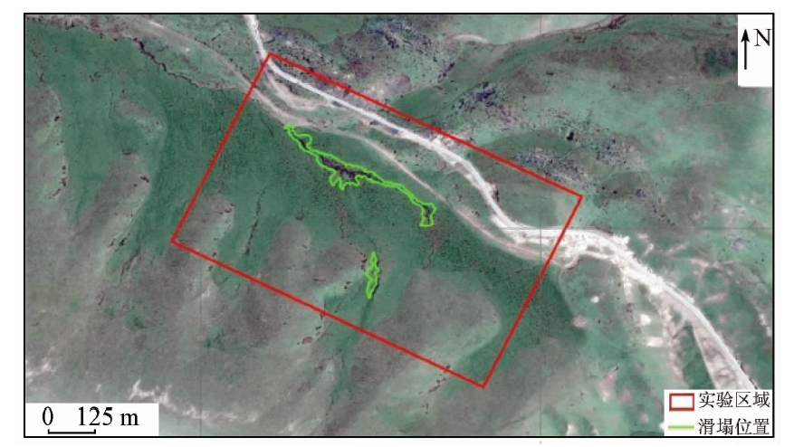
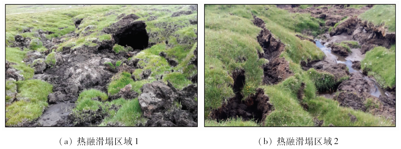
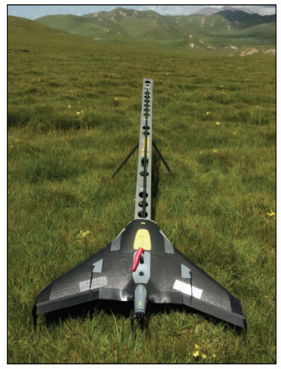
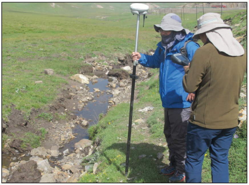
Abstract Global climate warming and human activities have caused large areas of permafrost degradation and thermal erosion gully in the Tibetan Plateau, seriously affecting the engineering construction and the ecological environment in permafrost regions. In this study, high resolution unmanned aerial vehicle (UAV) images and object-oriented classification approaches were applied to extracting the thermal erosion gullies in Eboling Mountain of Heihe River. Five kinds of object-oriented supervised learning algorithms, namely nearest neighbor, K-nearest neighbor, decision tree, support vector machine (SVM), and random forest, were analyzed for the capability and accuracy of the extraction of thermal erosion gullies in detail. The field GPS data were used for evaluating the classification accuracy. The results show that, in the object-oriented image analysis, the segmentation scale parameters have little effect on the extraction of thermal erosion gullies, wheres classification features have a greater impact, so it is important to select the appropriate classification features. The overall accuracies of the five machine learning methods are all over 90%, among which the Kappa coefficient of the SVM is higher than the other four classification methods. This means that SVM is more suitable for the thermal erosion gullies boundary extraction of UAV images in this study. The combination of high resolution UAV images and object-oriented classification methods has broad application prospects in the extraction of the thermal erosion gullies.
|
| Keywords
thermal erosion gully of permafrost
unmanned aerial vehicle
Eboling Mountain of Heihe River permafrost region
high spatial resolution images
object-oriented analysis
|
|
|
|
Corresponding Authors:
Liming JIANG
E-mail: jlm@whigg.ac.cn
|
|
Issue Date: 23 May 2019
|
|
|
| [1] |
周幼吾, 郭东信, 邱国庆 , 等. 中国冻土[M]. 北京: 科学出版社, 2000.
|
| [1] |
Zhou Y W, Guo D X, Qiu G Q , et al. Chinese Frozen Soil[M]. Beijing: Science Press, 2000.
|
| [2] |
Zhang T, Barry R G, Knowles K , et al. Statistics and characteristics of permafrost and ground ice distribution in the Northern Hemisphere[J]. Polar Geography, 1999,23(2):147-169.
|
| [3] |
Williams P J, Smith M W. The Frozen Earth [M]. New York: Cambridge University Press, 1989.
|
| [4] |
周幼吾, 郭东信 . 我国多年冻土的主要特征[J]. 冰川冻土, 1982,4(1):1-19.
|
| [4] |
Zhou Y W, Guo D X . Principal characteristics of permafrost in China[J]. Journal of Glaciology and Cryopedology, 1982,4(1):1-9.
|
| [5] |
牟翠翠, 张廷军, 曹斌 , 等. 祁连山区黑河上游俄博岭多年冻土区活动层碳储量研究[J]. 冰川冻土, 2013,35(1):1-9.
doi: 10.7522/j.issn.1000-0240.2013.0001
|
| [5] |
Mu C C, Zhang T J, Cao B , et al. Study of the organic carbon storage in the active layer of permafrost over the Eboling Mountain in the upper reaches of the Heihe River in the eastern Qilian Mountains[J]. Journal of Glaciology and Geocryology, 2013,35(1):1-9.
|
| [6] |
马立峰 . 多年冻土地区热融滑塌及其工程危害性的研究[D]. 兰州:中国科学院寒区旱区环境与工程研究所, 2006.
|
| [6] |
Ma L F . Study on Thaw Slump and Its Hazardness to Engineering in Permafrost Regions[D].Lanzhou:Cold and Arid Regions Environmental and Engineering Research Institute, Chinese Academy of Sciences, 2006.
|
| [7] |
Daniel H, Petra F, Francesco A , et al. A semi-automated object-based approach for landslide detection validated by persistent scatterer interferometry measures and landslide inventories[J]. Remote Sensing, 2012,4(5):1310-1336.
doi: 10.3390/rs4051310
url: http://www.mdpi.com/2072-4292/4/5/1310
|
| [8] |
甘甜, 李金平, 李小强 , 等. 面向对象的高分辨率遥感影像建筑物震害信息提取[J]. 测绘工程, 2015,24(4):11-15.
|
| [8] |
Gan T, Li J P, Li X Q , et al. Object-oriented method of building damage extraction from high-resolution images[J]. Engineering of Surveying and Mapping, 2015,24(4):11-15.
|
| [9] |
孙娜, 高志强, 王晓晶 , 等. 基于高分遥感影像的黄土高原地区水体高精度提取[J]. 国土资源遥感, 2017,29(4):173-178.doi: 10.6046/gtzyyg.2017.04.26.
|
| [9] |
Sun N, Gao Z Q, Wang X J , et al. High-precise extraction for water on the Loess Plateau region from high resolution satellite image[J]. Remote Sensing for Land and Resources, 2017,29(4):173-178.doi: 10.6046/gtzyyg.2017.04.26.
|
| [10] |
王岩, 王晓青, 窦爱霞 . 面向对象遥感分类方法在汶川地震震害提取中的应用[J]. 地震, 2009,29(3):54-60.
|
| [10] |
Wang Y, Wang X Q, Dou A X . Building damage detection of the 2008 Wenchuan,China earthquake based on object-oriented classification method[J]. Earthquake, 2009,29(3):54-60.
|
| [11] |
Kraaijenbrink P D A, Shea J M, Pellicciotti F , et al. Object-based analysis of unmanned aerial vehicle imagery to map and characterise surface features on a debris-covered glacier[J]. Remote Sensing of Environment, 2016,186:581-595.
doi: 10.1016/j.rse.2016.09.013
url: https://linkinghub.elsevier.com/retrieve/pii/S003442571630356X
|
| [12] |
Colomina I, Molina P . Unmanned aerial systems for photogrammetry and remote sensing:A review[J]. ISPRS Journal of Photogrammetry and Remote Sensing, 2014,92(2):79-97.
doi: 10.1016/j.isprsjprs.2014.02.013
url: https://linkinghub.elsevier.com/retrieve/pii/S0924271614000501
|
| [13] |
李德仁, 李明 . 无人机遥感系统的研究进展与应用前景[J]. 武汉大学学报(信息科学版), 2014,39(5):505-513.
doi: 10.13203/j.whugis20140045
|
| [13] |
Li D R, Li M . Research advance and application prospect of unmanned aerial vehicle remote sensing system[J]. Geomatics and Information Science of Wuhan University, 2014,39(5):505-513.
|
| [14] |
Baatz M,Schäpe A .An optimization approach for high quality multi-scale image segmentation[EB/OL]. http://test.ecognition.com/sites/default/files/405_baatz_fp_12.pdf.
|
| [15] |
王旭东, 段福洲, 屈新原 , 等. 面向对象和SVM结合的无人机数据建筑物提取[J]. 国土资源遥感, 2017,29(1):97-103.doi: 10.6046/gtzyyg.2017.01.15.
|
| [15] |
Wang X D, Duan F Z, Qu X Y , et al. Building extraction based on UAV imagery data with the synergistic use of objected-based method and SVM classifier[J]. Remote Sensing for Land and Resources, 2017,29(1):97-103.doi: 10.6046/gtzyyg.2017.01.15.
|
| [16] |
Trimble Germany GmbH. eCognition Developer 8.64.1 User Guide[M]. Munchen:Trimble Germany Trappentreustre, 2011.
|
| [17] |
Benz U C, Hofmann P, Willhauck G , et al. Multi-resolution,object-oriented fuzzy analysis of remote sensing data for GIS-ready information[J]. ISPRS Journal of Photogrammetry and Remote Sensing, 2004,58(3):239-258.
doi: 10.1016/j.isprsjprs.2003.10.002
url: https://linkinghub.elsevier.com/retrieve/pii/S0924271603000601
|
|
Viewed |
|
|
|
Full text
|
|
|
|
|
Abstract
|
|
|
|
|
Cited |
|
|
|
|
| |
Shared |
|
|
|
|
| |
Discussed |
|
|
|
|
 2019,
Vol. 31
2019,
Vol. 31