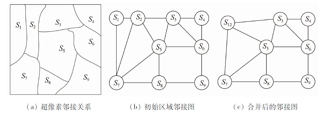
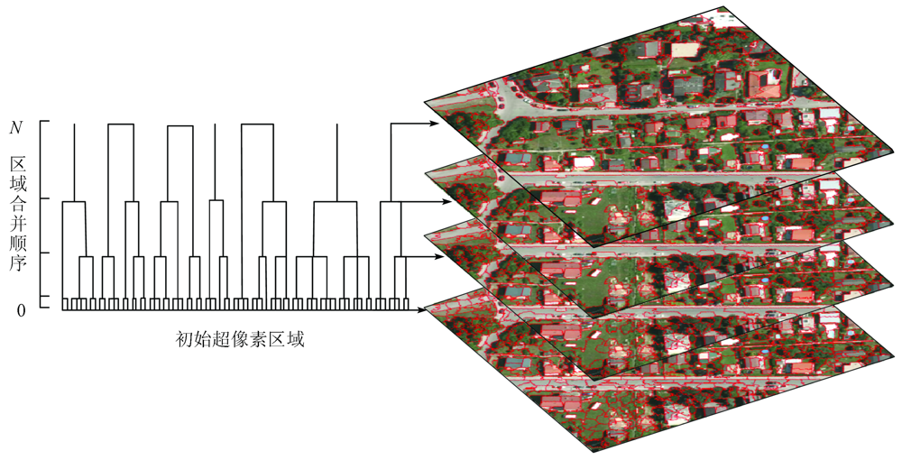
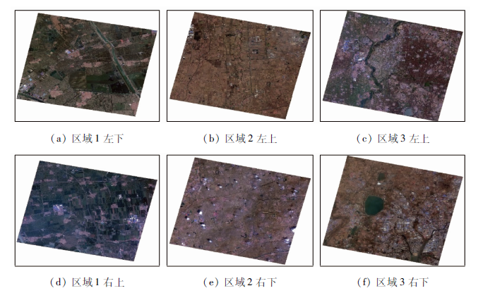
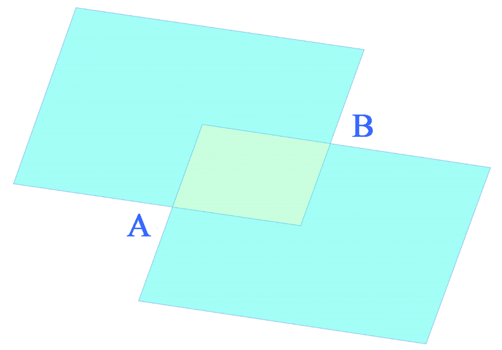
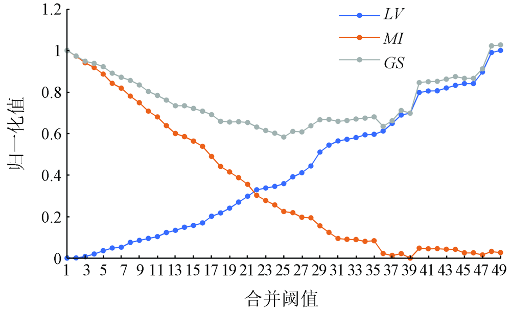
The extraction of mosaic lines is an important step in the mosaic of remote sensing images. To address the problems related to mosaic line extraction existing in current mosaic techniques of high-resolution remote sensing images, the authors propose a mosaic line extraction method based on multi-scale segmentation and the A* algorithm and the steps are as follows. First, pre-segment the overlapping regions of images using the simple linear iterative cluster (SLIC) algorithm, and conduct the clustering of regions with notable surface features to generate compact superpixels to obtain and extract the texture information of the surface features in the images. Then, merge the adjacent regions by continuously increasing the regional dissimilarity threshold while recording the region merging process using a scale set model. Meanwhile, determine the optimal segmentation scale according to the local variance of spectral characteristics and the Moran index to solve the problem of over-segmentation. Finally, find out the best mosaic lines on the segmentation paths using the A* algorithm. Experimental results prove that this method can effectively solve the problem that mosaic lines pass through distinct areas such as buildings, farmlands, and rivers, thus reducing splicing traces. Meanwhile, the optimal segmentation scale can be effectively selected by recording the merging process using a scale set model. Therefore, the mosaic line extraction method proposed in this study can be widely applied in the mosaic of high-resolution remote sensing images and is practically significant for the automatic mosaic of remote sensing images.
温银堂, 王铁柱, 王书涛, 王贵川, 刘诗瑜, 崔凯. 基于多尺度分割的高分辨率遥感影像镶嵌线自动提取[J]. 自然资源遥感, 2021, 33(4): 64-71.
WEN Yintang, WANG Tiezhu, WANG Shutao, Wang Guichuan, LIU Shiyu, CUI Kai. Automatic extraction of mosaic lines from high-resolution remote sensing images based on multi-scale segmentation. Remote Sensing for Natural Resources, 2021, 33(4): 64-71.
Xu G H, Liu Q H, Chen L F, et al. Remote sensing for China’s sustainable development:Opportunities and challenges[J]. Journal of Remote Sensing, 2016,20(5):679-688.
[2]
薛白. 多源遥感卫星影像镶嵌技术方法研究[D]. 北京:中国地质大学(北京), 2019.
Xue B. Study on the mosaic technique of multi-source remote sensing satellite images[D]. Beijing:China University of Geosciences(Beijing), 2019.
Gui X, Cheng P G, Nie Y J, et al. Image mosaicking seamline approach based on the morphological and Dijkstra algorithm[J]. Geomatics & Spatial Information Technology, 2015,38(7):18-20.
Zhou Q H, Pan J, Li D R. Overview of automatic generation of mosaicking seamlines for remote sensing images[J]. Remote Sensing for Land and Resources, 2013,25(2):1-7.doi: 10.6046/gtzyyg.2013.02.01.
doi: 10.6046/gtzyyg.2013.02.01
Gong S W, Chen S Y, Cai Y. Seamline detection for orthoimage mosaicking based on minimizing the maximum edge weight algorithm[J]. Journal of Geomatics, 2020,45(4):104-109.
Zuo Z Q, Zhang Z X, Zhang J Q, et al. Seamlines intelligent detection in large-scale urban orthoimage mosaicking[J]. Acta Geodaetica et Cartographica Sinica, 2011,40(1):84-89.
[7]
Pan J, Zhou Q, Wang M. Seamline determination based on segmentation for urban image mosaicking[J]. IEEE Geoscience & Remote Sensing Letters, 2014,11(8):1335-1339.
Zhong B. Study on method of generating mosaic lines automatically based on the initial planning network[J]. Geomatics & Spatial Information Technology, 2016,39(1):211-213.
[9]
Wan Y C, Wang D L, Xiao J H, et al. Automatic determination of seamlines for aerial image mosaicking based on vector roads alone[J]. ISPRS Journal of Photogrammetry and Remote Sensing, 2013,76:1-10.
doi: 10.1016/j.isprsjprs.2012.11.002
[10]
韩天庆. 结合SURF和分水岭分割的遥感影像镶嵌线提取[D]. 徐州:中国矿业大学, 2014.
Han T Q. Seamline extraction for remote sensing images by incorporating SURF and watershed segmentation[D]. Xuzhou:China University of Mining and Technology, 2014.
Yue G J, Du L M, Liu F D, et al. Automatic seamline detection for orthophoto mosaicking based on A* searching algorithm[J]. Science of Surveying and Mapping, 2015,40(4):151-154.
[12]
Bai X D, Cao Z G, Wang Y, et al. Image segmentation using modified SLIC and Nyström based spectral clustering[J]. OPTIK, 2014,125(16):4302-4307.
doi: 10.1016/j.ijleo.2014.03.035
Yao B X, Huang L, Xu Y S. A high resolution remote sensing image segmentation method based on superpixel and graph theory[J]. Remote Sensing for Land and Resources, 2019,31(3):72-79.doi: 10.6046/gtzyyg.2019.03.10.
doi: 10.6046/gtzyyg.2019.03.10
[14]
Wang Y, Qi Q, Shen X J. Image segmentation of brain MRI based on LTriDP and superpixels of improved SLIC[J]. Brain Sciences, 2020,10(2):116-130.
doi: 10.3390/brainsci10020116
[15]
Achanta R, Shaji A, Smith K, et al. SLIC superpixels compared to state-of-the-art superpixel methods[J]. IEEE Trans actions on Pattern Analysis and Machine Intelligence, 2012,34(11):2274-2282.
[16]
Boemer F, Ratner E, Lendasse A. Parameter-Free image segmentation with SLIC[J]. Neurocomputing, 2018,277(1):228-236.
doi: 10.1016/j.neucom.2017.05.096
Liu Y X, Du J, Zhang Q. Performance comparison between A* algorithm and Dijkstra algorithm based on path optimization[J]. Modern Electronics Technique, 2017,40(13):181-183,186.
[18]
Hu Z W, Zhang Q, Zou Q, et al. Stepwise evolution analysis of the region-merging segmentation for scale parameterization[J]. IEEE Journal of Selected Topics in Applied Earth Observations and Remote Sensing, 2018,11(7):2461-2472.
doi: 10.1109/JSTARS.4609443
[19]
Zheng M T, Xiong X D, Zhu J F. A novel orthoimage mosaic method using a weighted A* algorithm:Implementation and evaluation[J]. ISPRS Journal of Photogrammetry and Remote Sensing, 2018,138:30-46.
doi: 10.1016/j.isprsjprs.2018.02.007
[20]
Vincent L, Soille P. Watersheds in digital spaces:An efficient algorithm based on immersion simulations[J]. IEEE Transactions on Pattern Analysis and Machine Intelligence, 1991,13(6):583-598.
doi: 10.1109/34.87344
 2021, Vol. 33
  ), 王铁柱, 王书涛(