A study of crop planting type recognition based on SAR and optical remote sensing data
JIANG Shan1,2(), WANG Chun2,3, SONG Hongli1, LIU Yufeng2
1. School of Geosciences and Engineering, Hebei University of Engineering, Handan 056000, China 2. Anhui Key Laboratory of Physical Geography and Environment of Chuzhou University, Chuzhou 239000, China 3. School of Remote Sensing and Mapping Engineering, Nanjing University of Information Engineering, Nanjing 210044, China
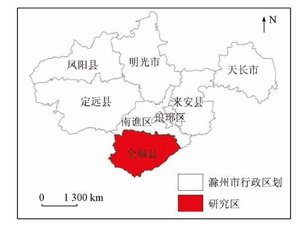
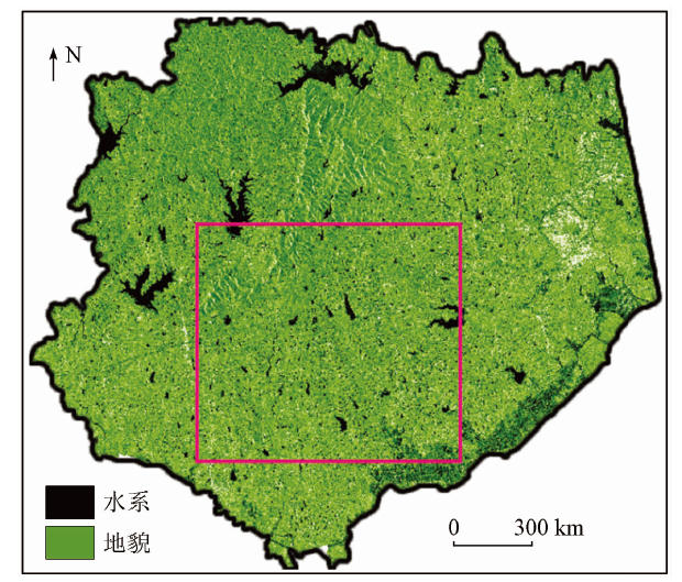
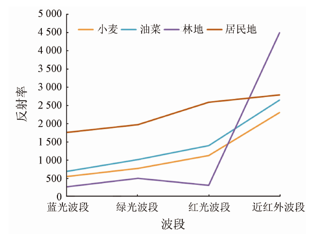
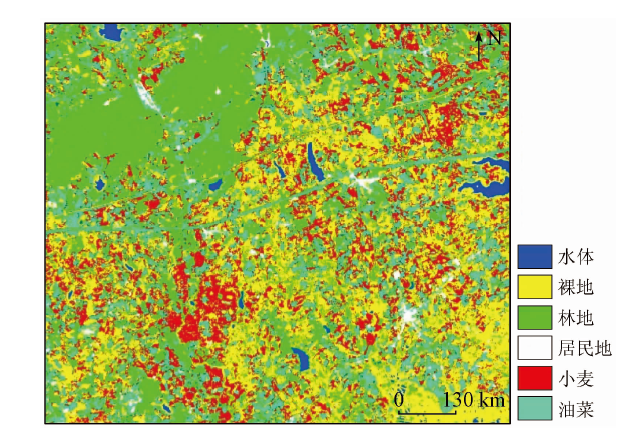
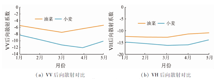
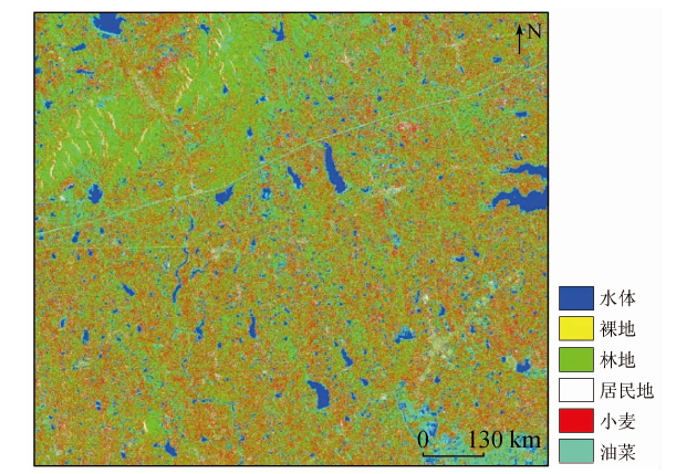
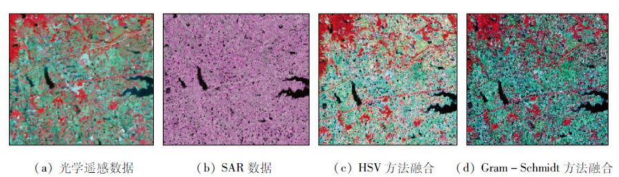
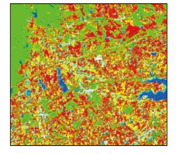
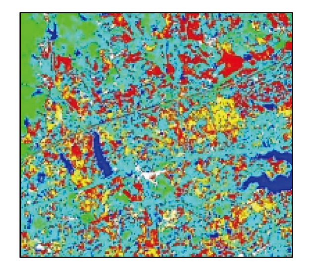
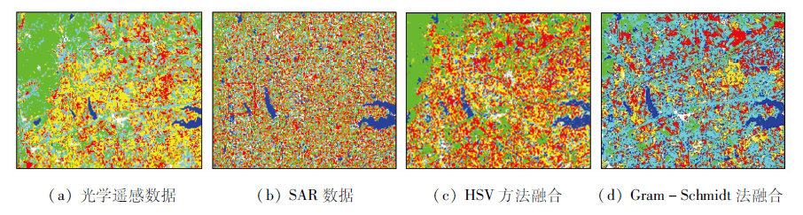
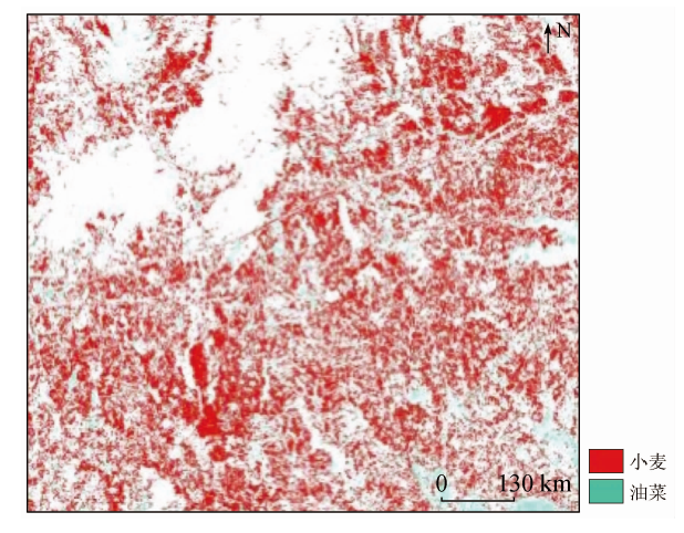
In order to acquire the appropriate remote sensing data to obtain the plant growth information and identify the planting types of crops, the authors chose Quanjiao of Chuzhou in Anhui Province as the research area and the SAR (GF-3) data and optical remote sensing data as the data source to fuse optical data with the SAR data and make a comparative study of data classification results, optical and SAR data classification results and the data fusion results so as to conduct crop type identification. The comparison of the data of classification results reveals that SAR data can be used as a good auxiliary optical image for crop planting types in crop recognition. The fusion of SAR data and optical remote sensing data has a good identification effect on crops in the research area.
江珊, 王春, 宋宏利, 刘玉锋. 基于SAR与光学遥感数据相结合的农作物种植类型识别研究[J]. 国土资源遥感, 2020, 32(4): 105-110.
JIANG Shan, WANG Chun, SONG Hongli, LIU Yufeng. A study of crop planting type recognition based on SAR and optical remote sensing data. Remote Sensing for Land & Resources, 2020, 32(4): 105-110.
Hong T. Detection and recognition of specific targets based on optical remote sensing image[D]. Chengdu:University of Electronic Science and Technology, 2018.
Zhou T, Pan J J, Han T, et al. Extraction of winter wheat planting area based on multi temporal SAR and optical image[J]. Transactions of the Chinese Society of Agricultural Engineering, 2017,33(10):215-221.
[3]
Gang H, Zhang A N, Zhou F Q, et al. Integration of optical and synthetic aperture Radar (SAR) images to differentiate grassland and alfalfa in prairie area[J]. International Journal of Applied Earth Observation and Geoinformation, 2014,28:12-19.
doi: 10.1016/j.jag.2013.10.003
[4]
Jia K, Li Q Z, Tian Y C, et al. Crop classification using multi-configuration SAR data in the North China Plain[J]. Information Journal of Remote Sensing, 2012,33(1/2):170-183.
Dong C X, Wang D, Zhou Q B, et al. Identification of autumn harvest crops in northern dry land based on SAR remote sensing[J]. Journal of China Agricultural Resources and Regional Planning, 2016,37(8):27-36.
Wang D, Zhou Q B, Chen Z X, et al. Research progress of crop reco-gnition based on SAR[J]. Transactions of the Chinese Society of Agricultural Engineering, 2014,30(16):203-212.
Hu J C. Research on tobacco identification method based on high resolution synthetic aperture Radar (SAR) in plateau mountainous area[D]. Guiyang:Guizhou Normal University, 2015.
Cheng Q, Wang C C, Zhang J C. Surface coverage classification of RADARSAT-2 full polarization SAR data[J]. Engineering of Surveying and Mapping, 2015,24(4):61-65
[9]
王博. 星载SAR与光学数据融合处理与应用关键技术研究[D]. 武汉:武汉大学, 2015.
Wang B. Research on key technologies of on-board SAR and optical data fusion processing and application[D]. Wuhan:Wuhan University, 2015.
Xu Q Y, Yang G J, Long H L, et al. Crop information identification based on MODIS NDVI time-series data[J]. Transactions of the Chinese Society of Agricultural Engineering, 2014,30(11):134-144.
Dong C X. Identification of dry land crops and inversion of biological parameters based on full polarization SAR data[D]. Beijing:Chinese Academy of Agricultural Sciences, 2016.
[12]
贺广均. 联合SAR与光学遥感数据的山区积雪识别研究[D]. 南京:南京大学, 2015.
He G J. Snow cover recognition in mountainous areas using SAR and optical remote sensing data[D]. Nanjing:Nanjing University, 2015.
 2020, Vol. 32
  ), 王春2,3, 宋宏利1, 刘玉锋2