1. Sichuan Key Laboratory of Evaluation and Utilization of Rare Earth Strategic Resources, Chengdu 610081, China 2. Sichuan Geological Survey Institute, Chengdu 610036, China 3. College of Earth Sciences, Chengdu University of Technology, Chengdu 610051, China
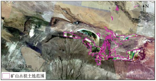
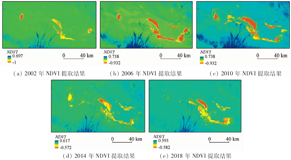
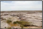
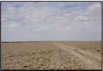
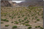
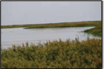
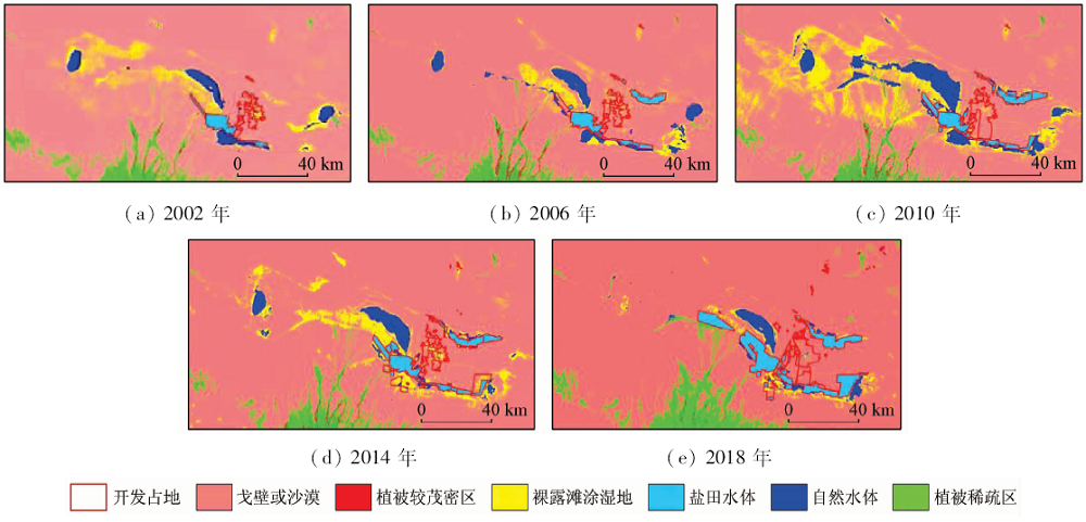
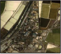
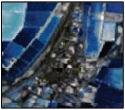
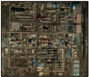
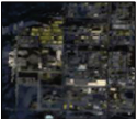
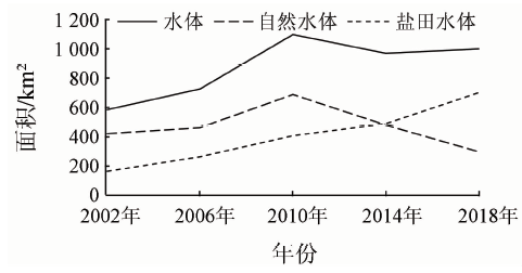
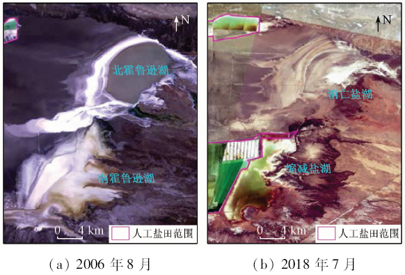
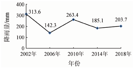
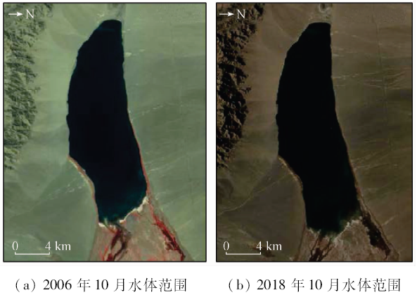
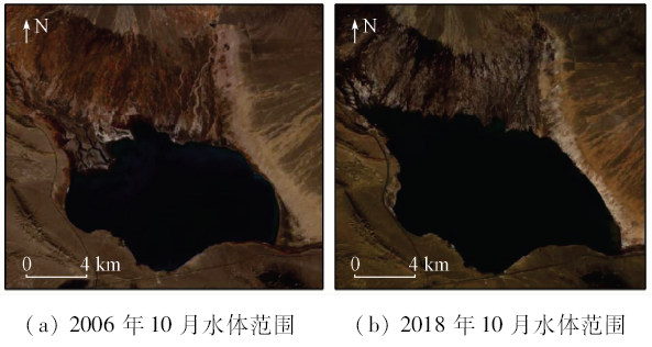
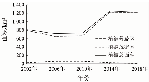
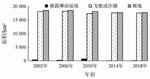
The Chaerhan Salt Lake contains abundant inorganic salts such as sodium chloride, potassium chloride and magnesium chloride, and it is also one of the mining bases in China. In recent years, with the rapid development of industrial mining activities in the Chaerhan Salt Lake and its surrounding salty field, the water quality of the salt lake has been polluted, and the lake water area has also rapidly decreased. By calculating the normalized vegetation index (NDVI) for the study area in 2002—2018, the authors obtained vegetation changes in the study area. Using remote sensing monitoring methods and combined with various factors such as rainfall and industrial development, the authors studied evolutionary trends and driving factors of the Chaerhan Salt Lake. Some conclusions have been reached: ① The development of salty field mine is the main factor causing the degradation of the Chaerhan Salt Lake. With the increase of the mining area of salt fields, the area of natural salt lakes has been greatly reduced, the amount of water has been reduced, and the salinization of water bodies has become serious. ② The area of the Chaerhan Salt Lake is affected by precipitation. In the years of abundant rainfall, the area of the salt lake has been larger, and smaller changes occur in the area of salt lakes in less rainy years. ③ Mining of salt fields will affect the growth of vegetation. According to the field investigation, salt field mining leads to serious salinization of salt lake water, and vegetation can hardly grow in the high salinity area, so there is less vegetation around the salt lake.
Yang X H, Sun X F, Huang J , et al. Analysis of driving factors and prevention measures for desertification in muli coal mining area in Qinghai Province[J]. The Chinese Journal of Geological Hazard and Control, 2018,29(1):78-84.
[2]
王宏森 . 矿山开发过程中循环经济研究[J]. 现代冶金, 2009,37(2):9-10.
Wang H S . Research on circular economy in the process of mine development[J]. Modern Metallurgy, 2009,37(2):9-10.
Zhao Y L . Remote sensing survey and proposal for protection of the natural resources in Guangdong-Hong Kong-Macao Greater Bay Area[J]. Remote Sensing for Land and Resources, 2018,30(4):139-147.doi: 10.6046/gtzyyg.2017373.
[4]
陈丽新 . 国外矿山环境治理的思考[J]. 经济研究导刊, 2014(27):265-266.
Chen L X . Reflections on comprehensive ecological improvement of mines abroad[J]. Economic Research Guide, 2014(27):265-266.
Yang X H, Huang J, Tian L , et al. Application of mine remote sensing monitoring to analysis of mine goaf stability[J]. Remote Sensing for Land and Resources, 2018,30(3):143-150.doi: 10.6046/gtzyyg.2018.03.20.
Zhao Z B, Bao H S . Overseas urban nature conservation,ecological rehabilitation and enlightenments to China[J]. Journal of Natural Resources, 2001,16(4):390-396.
Gu Z J, Zeng Z Y, Shi X Z , et al. Estimation models of vegetation fractional coverage (VFC) based on remote sensing image at different radiometric correction levels[J]. Chinese Journal of Applied Ecology, 2008,19(6):1296-1302.
Huang J F, Wang X Z, Wang R C , et al. Relation analysis beween the production of natural grassland and satallite vegetation indices[J]. Research of Agricultural Modernization, 2000,21(1):33-36.
China Geological Survey. DD2011—06 Technical Requirements for Remote Sensing Monitoring of Mineral Resources Development[S]. Beijing:China Geological Survey, 2011.
Liu H B, Shao X M, Huang L , et al. Statistical characteristics of annual precipitation variation during the past 1 000 years in Delingha,Qinghai Province,China[J]. Quaternary Sciences, 2005,25(2):176-183.
[15]
李永顺 . 近35年德令哈市降水量日数的特征分析[J]. 青海气象, 2017(2):41-44.
Li Y S . Characteristic analysis of precipitation days in Delingha City in recent 35 years[J]. Qinghai Meteorology, 2017(2):41-44.
 2020, Vol. 32