Please wait a minute...
 
Remote Sensing for Land & Resources    2018, Vol. 30 Issue (4) : 218-224     DOI: 10.6046/gtzyyg.2018.04.33
|
Design and implementation of remote sensing interpretation map database based on MapGIS and ArcGIS
Xinxin SUI, Suwen SUI
China Aero Geophysical Survey and Remote Sensing Center for Land and Resources, Beijing 100083, China
Download: PDF(5098 KB)   HTML
Export: BibTeX | EndNote | Reference Manager | ProCite | RefWorks    
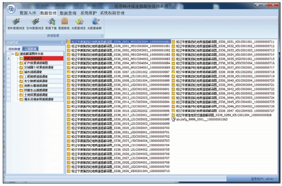
Abstract  

Remote sensing interpretation map has characteristics of complex sources and various formats, while the traditional image database system cannot display map symbols and manage spatial data simultaneously, which makes a large number of maps unused after field confirmation. Taking advantage of the MapGIS and ArcGIS platform in management of the map data and spatial data and considering the needs of users for map service, the method puts forward integrated storage and management of map data and element layers and develops the remote sensing interpretation map database system. According to the characteristics of maps, the flexible tool of importing data is designed. This system realizes the information and integration management of the multiple format maps, which greatly improves the service capability and research value of the maps.

Keywords remote sensing interpretation      map      MapGIS      ArcGIS      database     
:  TP311  
Issue Date: 07 December 2018
Service
E-mail this article
E-mail Alert
RSS
Articles by authors
Xinxin SUI
Suwen SUI
Cite this article:   
Xinxin SUI,Suwen SUI. Design and implementation of remote sensing interpretation map database based on MapGIS and ArcGIS[J]. Remote Sensing for Land & Resources, 2018, 30(4): 218-224.
URL:  
https://www.gtzyyg.com/EN/10.6046/gtzyyg.2018.04.33     OR     https://www.gtzyyg.com/EN/Y2018/V30/I4/218
Fig.1  System framework
Fig.2  Database structure
Fig.3  Database management system structure
Fig.4  Flow chart of database construction
Fig.5  System main interface
Fig.6  Display interface of map data and spatial data
[1] 王润生, 熊盛青, 聂洪峰 , 等. 遥感地质勘查技术与应用研究[J]. 地质学报, 2011,85(11):1699-1743.
[1] Wang R S, Xiong S Q, Nie H F , et al. Remote sensing technology and its application in geological exploration[J]. Acta Geologica Sinica, 2011,85(11):1699-1743.
[2] 其和日格, 韩志军 . 地质调查信息化建设[J].国土资源信息化, 2003(1):12-16.
url: http://d.wanfangdata.com.cn/Periodical_gtzyxxh200301002.aspx
[2] Qihe R G, Han Z J . Construction of geology survey infomatization[J].Land and Resources Infomatization, 2003(1):12-16.
[3] 茹湘兰, 王黔驹, 连健 , 等. 关于推进原始地质资料社会化服务的对策建议[J]. 中国矿业, 2013,22(7):49-52.
doi: 10.3969/j.issn.1004-4051.2013.07.014 url: http://www.cqvip.com/QK/92839A/201307/46388342.html
[3] Ru X L, Wang Q J, Lian J , et al. Proposals in the social service of original geological data[J]. China Mining Magazine, 2013,22(7):49-52.
[4] 郭豫宾, 何政伟, 许辉熙 . 应用MapGIS和ArcGIS构建矿产规划数据库[J]. 测绘与空间地理信息, 2009,32(5):127-129.
[4] Guo Y B, He Z W, Xu H X . Using MapGIS and ArcGIS construct inerals plan database[J]. Geomatics and Spatial Information Technology, 2009,32(5):127-129.
[5] 张文, 孟令奎, 周扬 , 等. 多源水利遥感数据的一体化管理机制研究[J].水利信息化, 2012(4):1-5.
url: http://d.wanfangdata.com.cn/Periodical/slswzdh201204003
[5] Zhang W, Meng L K, Zhou Y , et al. Study on integrated management mechanism of multi-resources remote sensing data for water conservancy[J].Water Resources Informatization, 2012(4):1-5.
[6] 叶水盛, 袁鑫 . 地学综合信息图库管理系统的进一步开发应用[J]. 吉林大学学报(地球科学版), 2010,40(3):726-732.
doi: 10.3969/j.issn.1671-5888.2010.03.036 url: http://www.cqvip.com/Main/Detail.aspx?id=34071814
[6] Ye S S, Yuan X . Further development and application of geosciences synthetic information maps database management system[J]. Journal of Jilin University(Earth Science Edition), 2010,40(3):726-732.
[7] 王建敏, 孟凡帅, 孙琳 . 地理信息产品综合浏览系统的建立[J]. 辽宁工程技术大学学报(自然科学版), 2010,30(3):378-381.
doi: 10.1018.003 url: http://d.wanfangdata.com.cn/Periodical/lngcjsdxxb201103014
[7] Wang J M, Meng F S, Sun L . Development of integrated browsing system for GIS products[J]. Journal of Liaoning Technical University (Natural Science), 2010,30(3):378-381.
[8] 王文志, 白云鹏, 王磊 , 等. 地质调查遥感数据服务系统设计与实现[J]. 地质力学学报, 2012,18(3):296-305.
doi: 10.3969/j.issn.1006-6616.2012.03.012 url: http://www.cqvip.com/QK/98414X/201203/44231442.html
[8] Wang W Z, Bai Y P, Wang L , et al. Design and implementation of remote sensing data service system for geological survey[J]. Journal of Geomechanics, 2012,18(3):296-305.
[1] SONG Renbo, ZHU Yuxin, GUO Renjie, ZHAO Pengfei, ZHAO Kexin, ZHU Jie, CHEN Ying. A method for 3D modeling of urban buildings based on multi-source data integration[J]. Remote Sensing for Natural Resources, 2022, 34(1): 93-105.
[2] LI Xiao, LIU Ying, YAO Weiling, YANG Jinzhong, LI Yongzhi, WANG Jie. Automatic plotting of illegal mines based on ArcPy[J]. Remote Sensing for Land & Resources, 2020, 32(3): 247-251.
[3] Yongquan WANG, Qingquan LI, Chisheng WANG, Jiasong ZHU, Xinyu WANG. Tethered UAVs-based applications in emergency surveying and mapping[J]. Remote Sensing for Land & Resources, 2020, 32(1): 1-6.
[4] Zhenyu MA, Bowei CHEN, Yong PANG, Shengxi LIAO, Xianlin QIN, Huaiqing ZHANG. Forest fire potential forecast based on FCCS model[J]. Remote Sensing for Land & Resources, 2020, 32(1): 43-50.
[5] Dingjian JIN, Jianchao WANG, Fang WU, Zihong GAO, Yachao HAN, Qi LI. Aerial remote sensing technology and its applications in geological survey[J]. Remote Sensing for Land & Resources, 2019, 31(4): 1-10.
[6] Qinglin TIAN, Wei PAN, Yao LI, Chuan ZHANG, Xuejiao CHEN, Zhangfa YU. Extraction of alteration information from hyperspectral core imaging based on wavelet packet transform and weight spectral angle mapper[J]. Remote Sensing for Land & Resources, 2019, 31(4): 41-46.
[7] Xiaoping XIE, Maowei BAI, Zhicong CHEN, Weibo LIU, Shuna XI. Remote sensing image interpretation and tectonic activity study of the active faults along the northeastern segment of the Longmenshan fault[J]. Remote Sensing for Land & Resources, 2019, 31(1): 237-246.
[8] Ke ZHANG, Jianzhong LIU, Weiming CHENG. Morphological features and spatial distribution of the lunar Copernican secondary craters[J]. Remote Sensing for Land & Resources, 2019, 31(1): 255-263.
[9] Wanjun LIU, Tianhui LI, Haicheng QU. Hyperspectral similar sample classification algorithm based on Fisher criterion and TrAdaboost[J]. Remote Sensing for Land & Resources, 2018, 30(4): 41-48.
[10] Xun ZHOU, Yuebin WANG, Suhong LIU, Peixin YU, Xikai WANG. A machine learning algorithm for automatic identification of cultivated land in remote sensing images[J]. Remote Sensing for Land & Resources, 2018, 30(4): 68-73.
[11] Jinghui FAN, Ruyi WANG, Hongli ZHAO, Yanming LI, Hao LIN, Yunpeng YAN. Research and production of a lenticular stereoscopic subsidence map[J]. Remote Sensing for Land & Resources, 2018, 30(4): 102-107.
[12] Xinxin SUI, Suwen SUI, Kun LIU. Research and construction of interpretation result data management system toward remote sensing application[J]. Remote Sensing for Land & Resources, 2018, 30(3): 238-243.
[13] Ruijun WANG, Bokun YAN, Mingsong LI, Shuangfa DONG, Yongbin SUN, Bing WANG. Remote sensing interpretation of important ore-controlling geological units in Hongshan Region of Gansu Province using GF-1 image and its application[J]. Remote Sensing for Land & Resources, 2018, 30(2): 162-170.
[14] Yanzuo WANG, Wei ZHOU, Lei FENG. Application of main memory database to spatial query of mass ZY1-02C data[J]. Remote Sensing for Land & Resources, 2018, 30(1): 238-242.
[15] WANG Yanzuo, SUI Xinxin, WEI Yingjuan, JIN Peidong. Application of image boundary extraction technology to satellite orthophoto database[J]. REMOTE SENSING FOR LAND & RESOURCES, 2017, 29(s1): 166-170.
Viewed
Full text


Abstract

Cited

  Shared   
  Discussed   
京ICP备05055290号-2
Copyright © 2017 Remote Sensing for Natural Resources
Support by Beijing Magtech