|
|
|
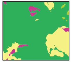
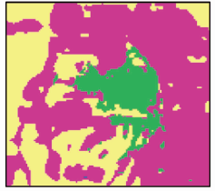
Abstract Timely and accurate acquisition of the spatial pattern evolution of land use can effectively support urban ecological environment protection and scientific management. In this study, the spatial characteristics of land use in multiple periods were extracted using a convolutional neural network. Then, they were combined with multiple spatial driving factors to build the long short-term memory network - cellular automata (LSTM-CA) model. Based on the data of land use classification, terrain, and urban traffic of the Zhangjiakou central urban area in 1995, 2000, 2005, 2010, and 2015, this study investigated the simulation methods for urban land use in 2020. By comparison with the precision of the multi-layer perceptron - cellular automata (MLP-CA) model, the proposed method has a Kappa coefficient of over 0.90 and FoM of 0.39. All indices are better than those of the MLP-CA model. Therefore, the LSTM-CA model can fully explore the internal relationships between the changes in historical land use and effectively improve the simulation precision.
|
| Keywords
land use
long short-term memory
cellular automata
change simulation
|
|
|
|
Issue Date: 27 December 2022
|
|
|
| [1] |
廖江福, 唐立娜, 王翠平, 等. 城市元胞自动机扩展邻域效应的测量与校准研究[J]. 地理科学进展, 2014, 33(12):1624-1633.
doi: 10.11820/dlkxjz.2014.12.005
|
| [1] |
Liao J F, Tang L N, Wang C P, et al. Measuring and calibrating extended neighborhood effect of urban cellular automata model based on particle swam optimization[J]. Progress in Geography, 2014, 33(12):1624-1633.
|
| [2] |
陈宝芬, 张耀民, 江东. 基于CA-ABM模型的福州城市用地扩张研究[J]. 地理科学进展, 2017, 36(5):626-634.
doi: 10.18306/dlkxjz.2017.05.010
|
| [2] |
Chen B F, Zhang Y M, Jiang D. Urban land expansion in Fuzhou City based on coupled cellular automata and agent-based models (CA-ABM)[J]. Progress in Geography, 2017, 36(5):626-634.
doi: 10.18306/dlkxjz.2017.05.010
|
| [3] |
孙毅中, 杨静, 宋书颖, 等. 多层次矢量元胞自动机建模及土地利用变化模拟[J]. 地理学报, 2020, 75(10):2164-2179.
doi: 10.11821/dlxb202010009
|
| [3] |
Sun Y Z, Yang J, Song S Y, et al. Modeling of multi-level vector cellular automata and its simulation of land use change based on urban planning[J]. Acta Geographica Sinica, 2020, 75(10):2164-2179.
|
| [4] |
田洁玫, 陈杰. 高标准粮田区鹤壁市土地利用情景模拟预测研究[J]. 国土资源遥感, 2018, 30(1):150-156.doi:10.6046/gtzyyg.2018.01.21.
doi: 10.6046/gtzyyg.2018.01.21
|
| [4] |
Tian J M, Chen J. Simulation and prediction of land use in the high standrad grain area of Hebi City[J]. Remote Sensing for Land and Resources, 2018, 30(1):150-156.doi:10.6046/gtzyyg.2018.01.21.
doi: 10.6046/gtzyyg.2018.01.21
|
| [5] |
杨俊, 解鹏, 席建超, 等. 基于元胞自动机模型的土地利用变化模拟——以大连经济技术开发区为例[J]. 地理学报, 2015, 70(3):461-475.
doi: 10.11821/dlxb201503009
|
| [5] |
Yang J, Xie P, Xi J C, et al. LUCC simulation based on the cellular automata simulation:A case study of Dalian Economic and Technological Development Zone[J]. Acta Geographica Sinica, 2015, 70(3):461-475.
|
| [6] |
张大川, 刘小平, 姚尧, 等. 基于随机森林CA的东莞市多类土地利用变化模拟[J]. 地理与地理信息科学, 2016, 32(5):29-36.
|
| [6] |
Zhang D C, Liu X P, Yao Y, et al. Simulating spatiotemporal change of multiple land use types in Dongguan by using random forest based on cellular automata[J]. Geography and Geo-Information Science, 2016, 32(5):29-36.
|
| [7] |
Xing W, Qian Y, Guan X, et al. A novel cellular automata model integrated with deep learning for dynamic spatio-temporal land use change simulation[J]. Computers and Geosciences, 2020, 137(1):1-9.
|
| [8] |
Von Neumann J. Theory of self-reproducing automata[J]. London:University of Illinois Press, 1966:3-14.
|
| [9] |
Karimi F, Sultana S, Babakan A S, et al. An enhanced support vector machine model for urban expansion prediction[J]. Computers,Environment and Urban Systems, 2019, 75(1):61-75.
doi: 10.1016/j.compenvurbsys.2019.01.001
url: https://linkinghub.elsevier.com/retrieve/pii/S0198971518304332
|
| [10] |
Shafizadeh-Moghadam H, Asghari A, Tayyebi A, et al. Coupling machine learning,tree-based and statistical models with cellular automata to simulate urban growth[J]. Computers,Environment and Urban Systems, 2017, 64(1):297-308.
doi: 10.1016/j.compenvurbsys.2017.04.002
url: https://linkinghub.elsevier.com/retrieve/pii/S0198971516302265
|
| [11] |
He J, Li X, Yao Y, et al. Mining transition rules of cellular automata for simulating urban expansion by using the deep learning techniques[J]. International Journal of Geographical Information Science, 2018, 32(10):2076-2097.
doi: 10.1080/13658816.2018.1480783
url: https://www.tandfonline.com/doi/full/10.1080/13658816.2018.1480783
|
| [12] |
Gounaridis D, Chorianopoulos I, Symeonakis E, et al. A random forest-cellular automata modelling approach to explore future land use/cover change in Attica (Greece),under different socio-economic realities and scales[J]. Science of the Total Environment, 2019, 64(6):320-335.
|
| [13] |
Grekousis G. Artificial neural networks and deep learning in urban geography:A systematic review and meta-analysis[J]. Computers,Environment and Urban Systems, 2019, 74(1):244-256.
doi: 10.1016/j.compenvurbsys.2018.10.008
url: https://linkinghub.elsevier.com/retrieve/pii/S0198971518302928
|
| [14] |
Guan D, Zhao Z, Tan J. Dynamic simulation of land use change based on logistic-CA-Markov and WLC-CA-Markov models:A case study in three gorges reservoir area of Chongqing,China[J]. Environmental Science and Pollution Research, 2019, 26(20):20669-20688.
doi: 10.1007/s11356-019-05127-9
url: https://doi.org/10.1007/s11356-019-05127-9
|
| [15] |
Jia X, Khandelwal A, Nayak G, et al. Incremental dual-memory lstm in land cover prediction[C]// Proceedings of the 23rd ACM SIGKDD international conference on knowledge discovery and data mining, 2017:867-876.
|
| [16] |
Wang H, Zhao X, Zhang X, et al. Long time series land cover classification in China from 1982 to 2015 based on Bi-LSTM deep learning[J]. Remote Sensing, 2019, 11(14):1-22.
doi: 10.3390/rs11010001
url: http://www.mdpi.com/2072-4292/11/1/1
|
| [17] |
White R, Engelen G. Cellular automata and fractal urban form:A cellular modelling approach to the evolution of urban land-use patterns[J]. Environment and Planning A, 1993, 25(8):1175-1199.
doi: 10.1068/a251175
url: http://journals.sagepub.com/doi/10.1068/a251175
|
| [18] |
Liu X, Liang X, Li X, et al. A future land use simulation model (FLUS) for simulating multiple land use scenarios by coupling human and natural effects[J]. Landscape and Urban Planning, 2017, 168(1):94-116.
doi: 10.1016/j.landurbplan.2017.09.019
url: https://linkinghub.elsevier.com/retrieve/pii/S0169204617302396
|
|
Viewed |
|
|
|
Full text
|
|
|
|
|
Abstract
|
|
|
|
|
Cited |
|
|
|
|
| |
Shared |
|
|
|
|
| |
Discussed |
|
|
|
|
 2022,
Vol. 34
2022,
Vol. 34
 ), XIA Jianxin(